File:Urmappe Ort Gemering.jpg

Size of this preview: 800 × 545 pixels. Other resolutions: 320 × 218 pixels | 640 × 436 pixels | 1,024 × 698 pixels | 1,263 × 861 pixels.
Original file (1,263 × 861 pixels, file size: 842 KB, MIME type: image/jpeg)
Captions
Captions
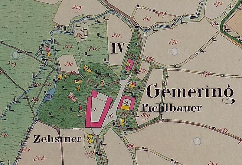
Map of the village Gemering in Upper Austria, Austria (from Urmappe of Franziszeischer Kataster, 1824-1830)
Summary edit
| Description | Urmappe Ausschnitt Ort Gemering, Bezirk St. Florian, Oberösterreich, Österreich |
| Date | 1824-1830 |
| Source | OPEN DATA OBERÖSTERREICH (https://e-gov.ooe.gv.at/at.gv.ooe.ogd2-citi/#/detail/ca15f49a-db0d-45f1-bc90-a6aba0be513a) |
| Author | Datenquelle: Land Oberösterreich - data.ooe.gv.at |
| Permission (Reusing this file) |
Creative Commons Namensnennung 4.0 International (CC BY 4.0) |
Licensing edit
This file is licensed under the Creative Commons Attribution 4.0 International license.
- You are free:
- to share – to copy, distribute and transmit the work
- to remix – to adapt the work
- Under the following conditions:
- attribution – You must give appropriate credit, provide a link to the license, and indicate if changes were made. You may do so in any reasonable manner, but not in any way that suggests the licensor endorses you or your use.
File history
Click on a date/time to view the file as it appeared at that time.
| Date/Time | Thumbnail | Dimensions | User | Comment | |
|---|---|---|---|---|---|
| current | 18:06, 13 November 2023 | | 1,263 × 861 (842 KB) | Optimale (talk | contribs) | {{Information |Description=Urmappe Ausschnitt Ort Gemering, Bezirk St. Florian, Oberösterreich, Österreich |Source=OPEN DATA OBERÖSTERREICH (https://e-gov.ooe.gv.at/at.gv.ooe.ogd2-citi/#/detail/ca15f49a-db0d-45f1-bc90-a6aba0be513a) |Date=1824-1830 |Author= |Permission=Creative Commons Namensnennung 4.0 International (CC BY 4.0) |other_versions= }} Category:Austria |
You cannot overwrite this file.
File usage on Commons
The following page uses this file:
File usage on other wikis
The following other wikis use this file:
- Usage on de.wikipedia.org