File:Ursulines de Quebec.png
Size of this preview: 500 × 600 pixels. Other resolutions: 200 × 240 pixels | 620 × 744 pixels.
Original file (620 × 744 pixels, file size: 210 KB, MIME type: image/png)
Captions
Captions
Add a one-line explanation of what this file represents
Summary
edit
| Description |
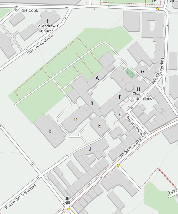
Français : Plan du complexe du Monastère des Ursulines-de-Québec
A - l'aile Sainte-Famille (1687, agrandie vers 1713) |
This photo is of a Properties in the Répertoire du patrimoine culturel du Québec, with site identifier 110102 |
|
| Date | |
| Source | Own work à partir de openstreetmap.org et wikimapia.org |
| Author | OpenStreetMap |
Licensing
edit
| This work has been released into the public domain by its author, OpenStreetMap. This applies worldwide. In some countries this may not be legally possible; if so: OpenStreetMap grants anyone the right to use this work for any purpose, without any conditions, unless such conditions are required by law. |
File history
Click on a date/time to view the file as it appeared at that time.
| Date/Time | Thumbnail | Dimensions | User | Comment | |
|---|---|---|---|---|---|
| current | 23:40, 12 June 2023 | | 620 × 744 (210 KB) | Jeangagnon (talk | contribs) | Uploaded own work with UploadWizard |
You cannot overwrite this file.
File usage on Commons
There are no pages that use this file.