File:Uttar Pradesh administrative divisions-sat.svg

Size of this PNG preview of this SVG file: 600 × 600 pixels. Other resolutions: 240 × 240 pixels | 480 × 480 pixels | 768 × 768 pixels | 1,024 × 1,024 pixels | 2,048 × 2,048 pixels | 1,500 × 1,500 pixels.
Original file (SVG file, nominally 1,500 × 1,500 pixels, file size: 123 KB)
Captions
Captions
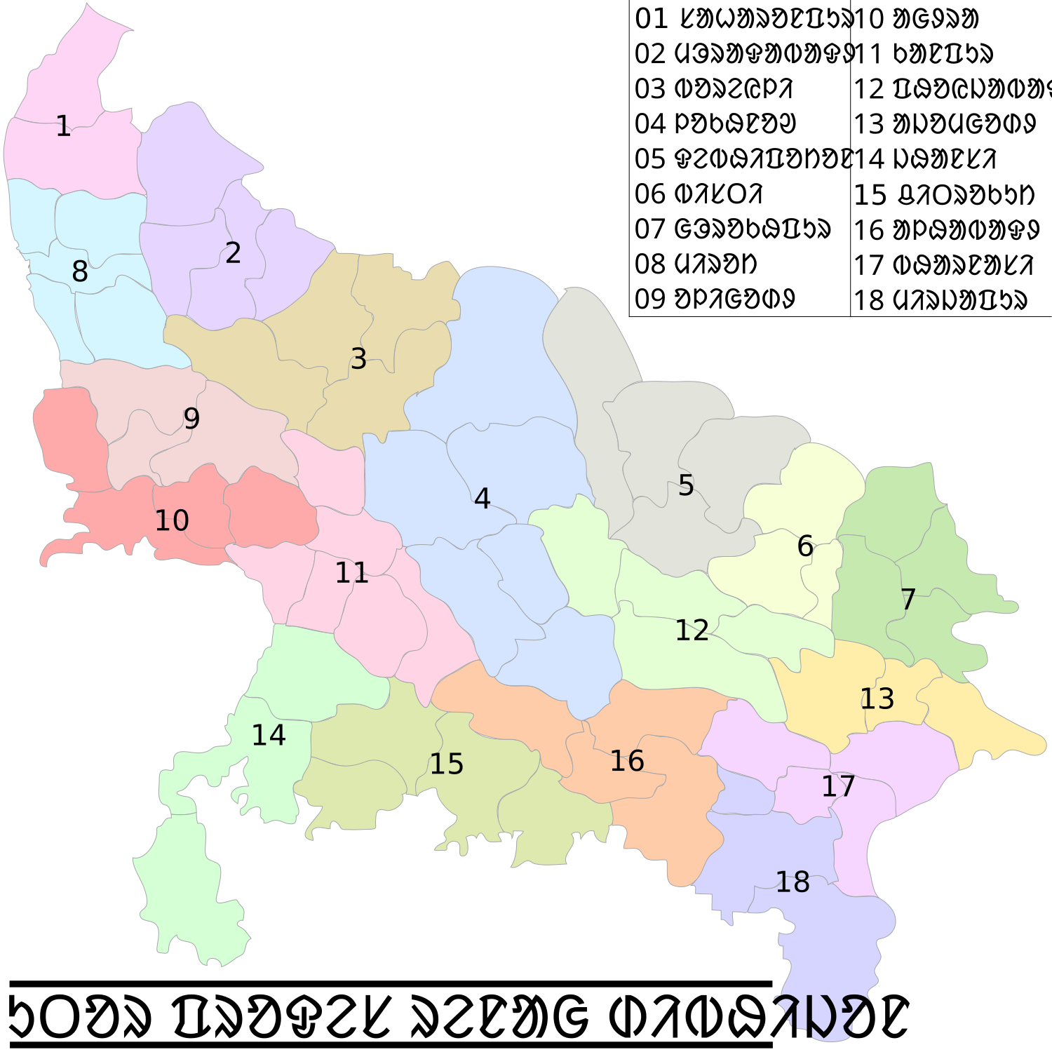
Uttar Pradesh administrative divisions
Summary edit
| Description |
English: This map has been translated by User:R Ashwani Banjan Murmu, it is based on Map of Uttar Pradesh on National Portal of India |
| Date | |
| Source |
 by User:Faizhaider by User:Faizhaider |
| Author | Translated into Santali by User:R Ashwani Banjan Murmu |
| Other versions |
[]
|


Licensing edit
| This file is made available under the Creative Commons CC0 1.0 Universal Public Domain Dedication. | |
| The person who associated a work with this deed has dedicated the work to the public domain by waiving all of their rights to the work worldwide under copyright law, including all related and neighboring rights, to the extent allowed by law. You can copy, modify, distribute and perform the work, even for commercial purposes, all without asking permission.
|
File history
Click on a date/time to view the file as it appeared at that time.
| Date/Time | Thumbnail | Dimensions | User | Comment | |
|---|---|---|---|---|---|
| current | 03:44, 28 February 2019 | | 1,500 × 1,500 (123 KB) | R Ashwani Banjan Murmu (talk | contribs) | User created page with UploadWizard |
You cannot overwrite this file.
File usage on Commons
The following 11 pages use this file:
- File:Uttar Pradesh administrative divisions-bn.svg
- File:Uttar Pradesh administrative divisions-gu.svg
- File:Uttar Pradesh administrative divisions-hi.svg
- File:Uttar Pradesh administrative divisions-kn.svg
- File:Uttar Pradesh administrative divisions-or.svg
- File:Uttar Pradesh administrative divisions-pa.svg
- File:Uttar Pradesh administrative divisions-sat.svg
- File:Uttar Pradesh administrative divisions-te.svg
- File:Uttar Pradesh administrative divisions.svg
- File:Uttar Pradesh administrative divisions as.svg
- Template:Other versions/Uttar Pradesh administrative divisions