File:Utupua or Edgecumbe Island 1968 62.5K map.jpg

Size of this preview: 505 × 599 pixels. Other resolutions: 202 × 240 pixels | 405 × 480 pixels | 647 × 768 pixels | 863 × 1,024 pixels | 1,726 × 2,048 pixels | 4,049 × 4,803 pixels.
Original file (4,049 × 4,803 pixels, file size: 4.84 MB, MIME type: image/jpeg)
Captions
Captions
Add a one-line explanation of what this file represents
Summary
edit
| Description |
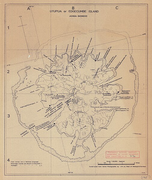
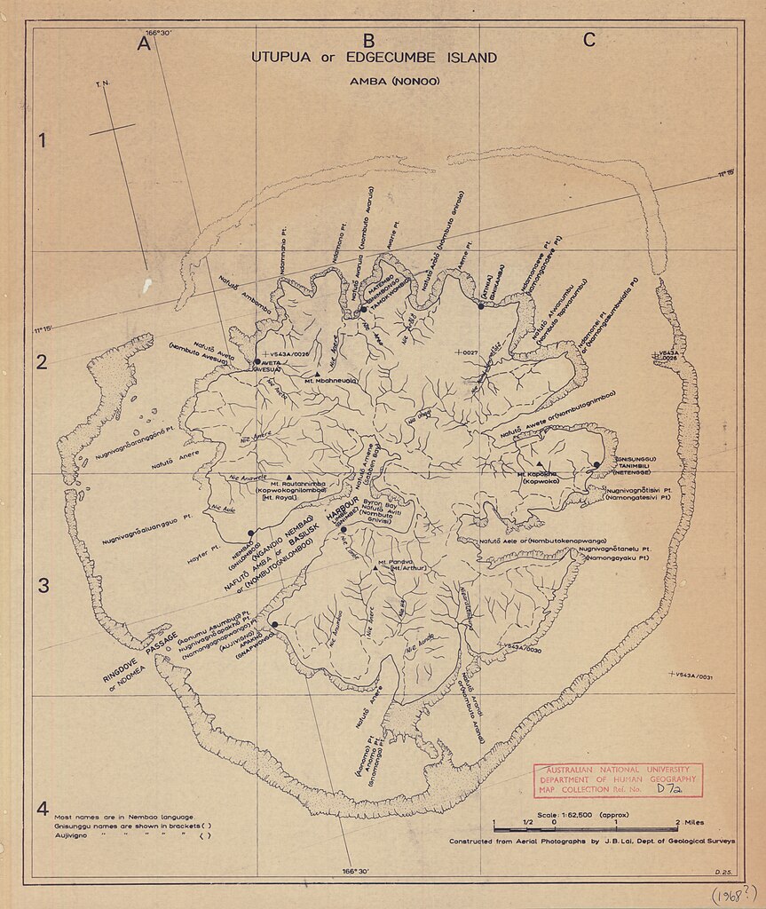
English: 1968 map of Utupua Island, Temotu Province, Solomon Islands, Melanesia, South Pacific Ocean |
| Date | |
| Source | https://openresearch-repository.anu.edu.au/handle/1885/145246 |
| Author | Departments of Geological Surveys and Lands & Surveys (?) |
Licensing
edit
This work created by the United Kingdom Government is in the public domain.
This is because it is one of the following:
HMSO has declared that the expiry of Crown Copyrights applies worldwide (ref: HMSO Email Reply)
|
 |
File history
Click on a date/time to view the file as it appeared at that time.
| Date/Time | Thumbnail | Dimensions | User | Comment | |
|---|---|---|---|---|---|
| current | 13:23, 21 March 2019 | | 4,049 × 4,803 (4.84 MB) | Ratzer (talk | contribs) | User created page with UploadWizard |
You cannot overwrite this file.
File usage on Commons
The following page uses this file:
File usage on other wikis
The following other wikis use this file: