File:Uudenmaakatu 16, Asemakaavan sallima kolmen tontin yhdistäminen - D5032 - hkm.HKMS000005-km0000ovef.jpg
Size of this preview: 800 × 521 pixels. Other resolutions: 320 × 208 pixels | 640 × 416 pixels | 1,024 × 666 pixels | 1,280 × 833 pixels | 2,560 × 1,666 pixels | 6,326 × 4,116 pixels.
Original file (6,326 × 4,116 pixels, file size: 4.67 MB, MIME type: image/jpeg)
Captions
Captions
Add a one-line explanation of what this file represents
Summary
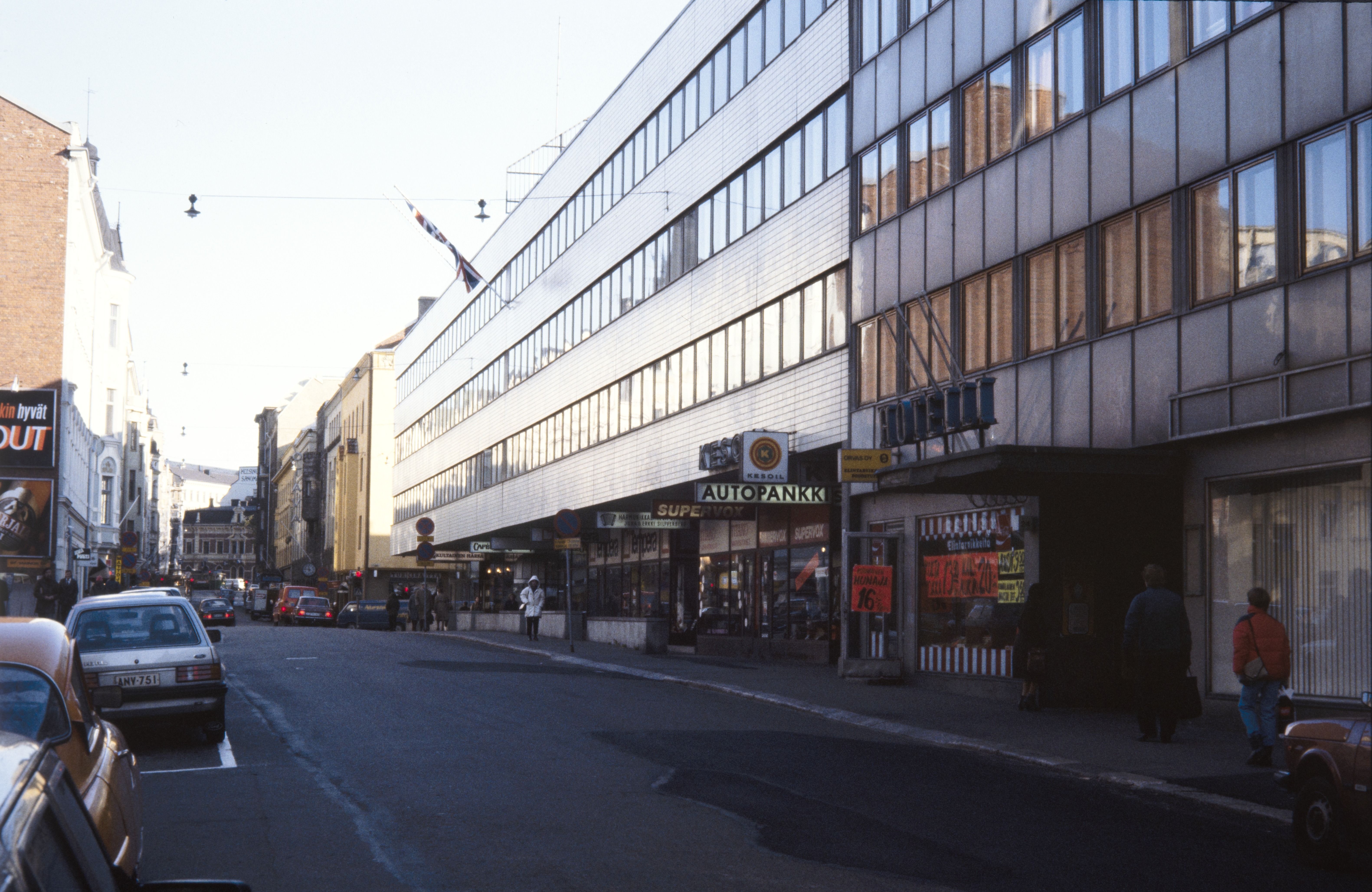
edit| Suomi: Uudenmaakatu 16. Asemakaavan sallima kolmen tontin yhdistäminen
( |
||||||||||||||||||||||||
|---|---|---|---|---|---|---|---|---|---|---|---|---|---|---|---|---|---|---|---|---|---|---|---|---|
| Photographer |
Unknown author |
|||||||||||||||||||||||
| Title |
Suomi: Uudenmaakatu 16. Asemakaavan sallima kolmen tontin yhdistäminen |
|||||||||||||||||||||||
| Description |
Suomi: Uudenmaakatu 16. Asemakaavan sallima kolmen tontin yhdistäminen. Esimerkki kaupungin keskustassa 1960-luvulla yleistyneestä vanhojen rakennusten purkamisesta ja uudisrakennusten rakentamisesta halvempana vaihtoehtona korjaamiselle. Kuvassa ensimmäinen rakennus oikealla Uudenmaankatu 24. -- , , väri |
|||||||||||||||||||||||
| Depicted place | Helsinki, Uudenmaankatu 16. Uudenmaankatu 24. | |||||||||||||||||||||||
| Date | 1980 -luku? | |||||||||||||||||||||||
| Collection |
|
|||||||||||||||||||||||
| Accession number |
D5032 |
|||||||||||||||||||||||
| Source | Finna: hkm.HKMS000005:km0000ovef | |||||||||||||||||||||||
| Permission (Reusing this file) |
CC BY 4.0 | |||||||||||||||||||||||

| Camera location | | View this and other nearby images on: OpenStreetMap |
|---|
Licensing
edit
This file is licensed under the Creative Commons Attribution 4.0 International license.
- You are free:
- to share – to copy, distribute and transmit the work
- to remix – to adapt the work
- Under the following conditions:
- attribution – You must give appropriate credit, provide a link to the license, and indicate if changes were made. You may do so in any reasonable manner, but not in any way that suggests the licensor endorses you or your use.
This file, which was originally posted to
Finna, was reviewed on 21 April 2023 by reviewer MDanielsBot, who confirmed that it was available there under the stated license on that date.
|
File history
Click on a date/time to view the file as it appeared at that time.
| Date/Time | Thumbnail | Dimensions | User | Comment | |
|---|---|---|---|---|---|
| current | 10:31, 5 August 2020 | | 6,326 × 4,116 (4.67 MB) | FinnaUploadBot (talk | contribs) | Uploading 'Uudenmaakatu_16,_Asemakaavan_sallima_kolmen_tontin_yhdistäminen_-_D5032_-_hkm.HKMS000005-km0000ovef.jpg' from Finna |
You cannot overwrite this file.
File usage on Commons
The following 2 pages use this file: