File:Västra Strö monumentet - KMB - 16000300030023.jpg
Original file (2,928 × 1,920 pixels, file size: 5.6 MB, MIME type: image/jpeg)
Captions
Captions
| Västra Strö monumentet
( |
|||||||||||||||||||||||||||
|---|---|---|---|---|---|---|---|---|---|---|---|---|---|---|---|---|---|---|---|---|---|---|---|---|---|---|---|
| Photographer |
|
||||||||||||||||||||||||||
| Title |
Västra Strö monumentet |
||||||||||||||||||||||||||
| Original caption |
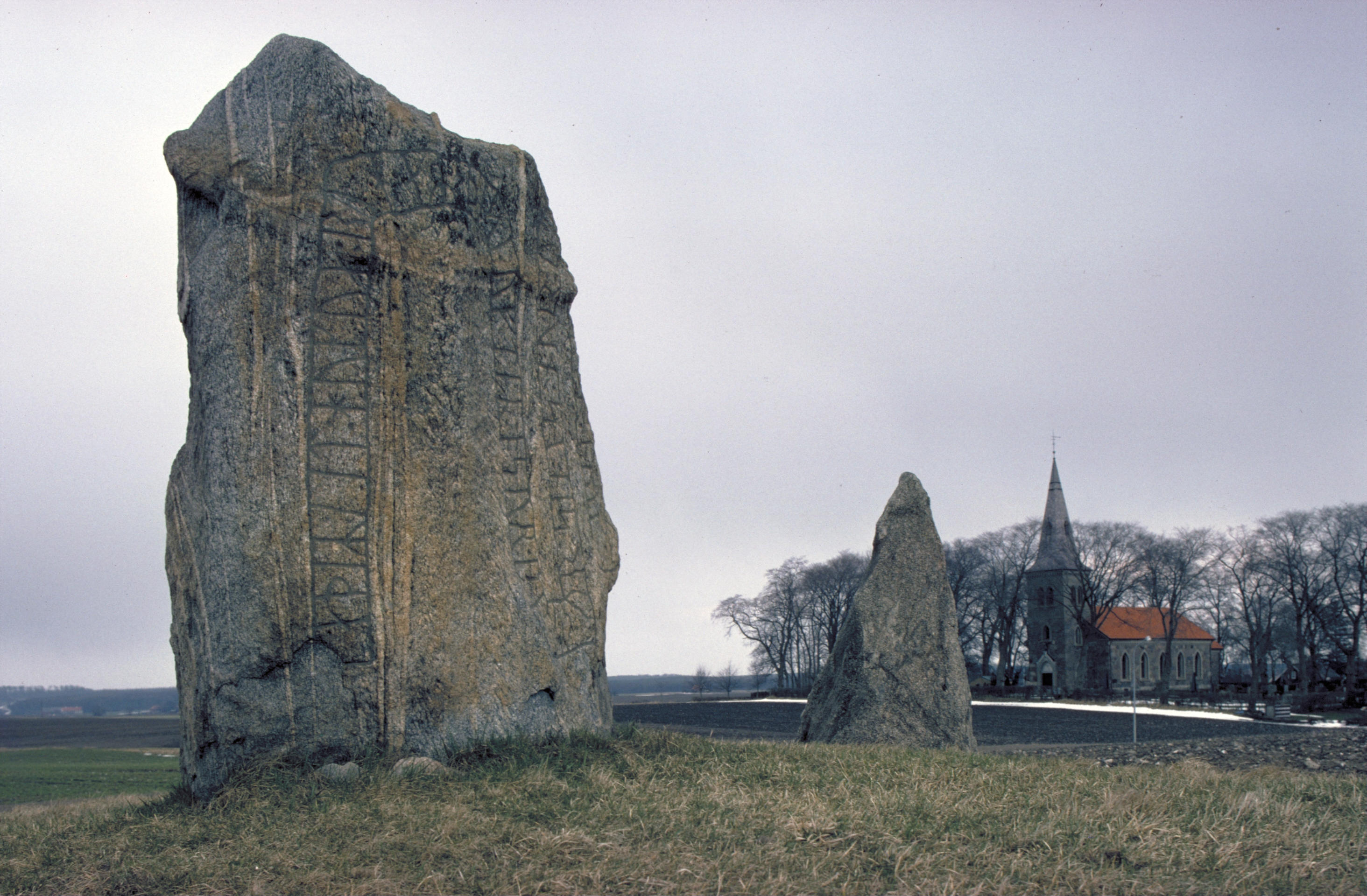
Notera Av dokumentationsskäl har originalbeskrivningen från Riksantikvarieämbetet behållits. Tillrättalägganden och alternativa beskrivningar bör införas separat från nedanstående information. Runstenarna DR334 och DR 335. Västra Strö kyrka i bakgrunden.Felaktigheter kan även anmälas till denna sida. Motiv: Västra Strö 2:3, Västra Strö 2:4, Västra Strö kyrka |
||||||||||||||||||||||||||
| Description |
Runstenarna DR334 och DR 335. Västra Strö kyrka i bakgrunden. Västra Strö 2:3, Västra Strö 2:4, Västra Strö kyrka.
|
||||||||||||||||||||||||||
| Depicted place | Sweden, Eslöv Municipality, Q10718370 | ||||||||||||||||||||||||||
| Date | Taken in 1980 | ||||||||||||||||||||||||||
| Collection |
|
||||||||||||||||||||||||||
| Accession number | |||||||||||||||||||||||||||
| Source |
Pål-Nils Nilsson / Kulturmiljöbild, Riksantikvarieämbetet
|
||||||||||||||||||||||||||
| Permission (Reusing this file) |
This file is licensed under the Creative Commons Attribution 2.5 Generic license. Attribution: Pål-Nils Nilsson / Riksantikvarieämbetet
|
||||||||||||||||||||||||||


| Object location | | View this and other nearby images on: OpenStreetMap |
|---|
File history
Click on a date/time to view the file as it appeared at that time.
| Date/Time | Thumbnail | Dimensions | User | Comment | |
|---|---|---|---|---|---|
| current | 16:36, 5 November 2021 | | 2,928 × 1,920 (5.6 MB) | VulpesVulpes42 (talk | contribs) | Högre upplösning. |
| 15:55, 9 June 2017 |  | 768 × 512 (81 KB) | AndreCostaWMSE-bot (talk | contribs) | {{Kulturmiljöbild-image | short title = Västra Strö monumentet | original description = Runstenarna DR334 och DR 335. Västra Strö kyrka i bakgrunden.<br> Motiv: Västra Strö 2:3, Västra Strö 2:4, Västra Strö kyrka<br> Nyckelord: Runor<br> Kat... |
You cannot overwrite this file.
File usage on Commons
The following 2 pages use this file:
File usage on other wikis
The following other wikis use this file:
- Usage on sv.wikipedia.org