File:VIEW SHOWING SOUTHWEST REAR OF NEPTUNE'S LOCK (LEFT) AND CAPTAIN'S GALLEY (RIGHT), LOOKING NORTHEAST - Huntington Beach Municipal Pier, Pacific Coast Highway at Main Street, HAER CAL,30-HUBE,1-68.tif

Size of this JPG preview of this TIF file: 751 × 599 pixels. Other resolutions: 301 × 240 pixels | 602 × 480 pixels | 962 × 768 pixels | 1,280 × 1,022 pixels | 2,560 × 2,043 pixels | 4,982 × 3,976 pixels.
Original file (4,982 × 3,976 pixels, file size: 18.89 MB, MIME type: image/tiff)
Captions
Captions
Add a one-line explanation of what this file represents
Summary edit
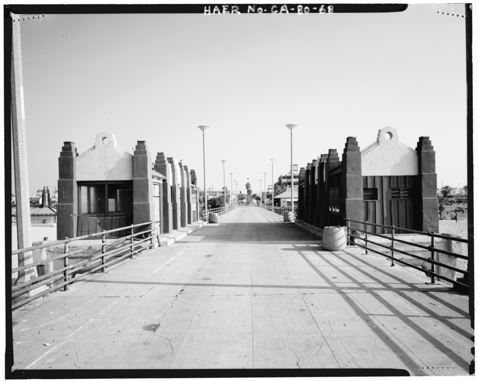
| VIEW SHOWING SOUTHWEST REAR OF NEPTUNE'S LOCK (LEFT) AND CAPTAIN'S GALLEY (RIGHT), LOOKING NORTHEAST - Huntington Beach Municipal Pier, Pacific Coast Highway at Main Street, Huntington Beach, Orange County, CA | ||||
|---|---|---|---|---|
| Photographer |
Dewey, William B., creator |
|||
| Title |
VIEW SHOWING SOUTHWEST REAR OF NEPTUNE'S LOCK (LEFT) AND CAPTAIN'S GALLEY (RIGHT), LOOKING NORTHEAST - Huntington Beach Municipal Pier, Pacific Coast Highway at Main Street, Huntington Beach, Orange County, CA |
|||
| Depicted place | California; Orange County; Huntington Beach | |||
| Date | 1989 | |||
| Dimensions | 4 x 5 in. | |||
| Current location |
Library of Congress Prints and Photographs Division Washington, D.C. 20540 USA http://hdl.loc.gov/loc.pnp/pp.print |
|||
| Accession number |
HAER CAL,30-HUBE,1-68 |
|||
| Credit line |
|
|||
| Source | https://www.loc.gov/pictures/item/ca1561.photos.014152p | |||
| Permission (Reusing this file) |
|
|||

| Camera location | | View this and other nearby images on: OpenStreetMap |
|---|
File history
Click on a date/time to view the file as it appeared at that time.
| Date/Time | Thumbnail | Dimensions | User | Comment | |
|---|---|---|---|---|---|
| current | 21:10, 3 July 2014 |  | 4,982 × 3,976 (18.89 MB) | Fæ (talk | contribs) | GWToolset: Creating mediafile for Fæ. HABS batch upload 2 July 2014 (301:400) |
You cannot overwrite this file.
File usage on Commons
The following page uses this file: