File:Val-d'Oise department location map.svg

Size of this PNG preview of this SVG file: 800 × 407 pixels. Other resolutions: 320 × 163 pixels | 640 × 326 pixels | 1,024 × 521 pixels | 1,280 × 651 pixels | 2,560 × 1,303 pixels | 1,529 × 778 pixels.
Original file (SVG file, nominally 1,529 × 778 pixels, file size: 345 KB)
Captions
Captions
Add a one-line explanation of what this file represents
Summary
edit| Camera location | | View this and other nearby images on: OpenStreetMap |
|---|
| Description |
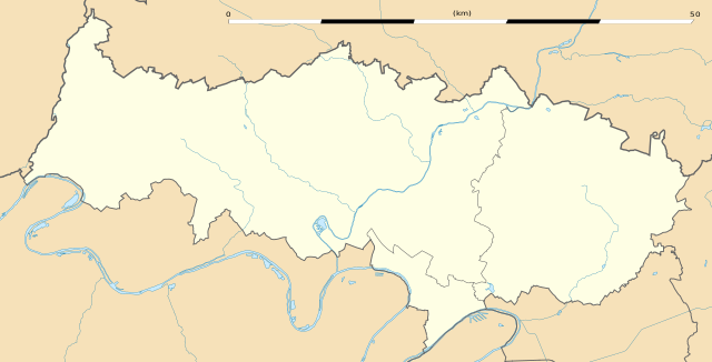
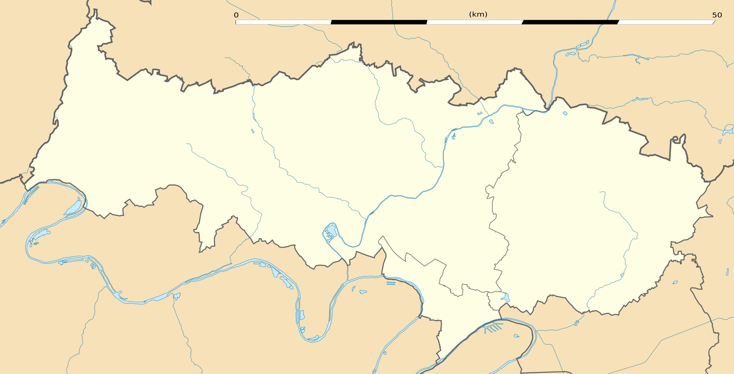
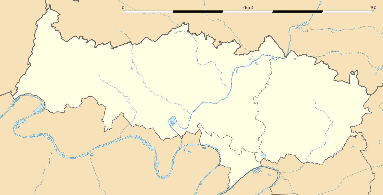
English: Blank administrative map of the department of Val-d'Oise, France, as in January 2015, for geo-location purpose, with distinct boundaries for regions, departments and arrondissements.
Français : Carte administrative vierge du département du Val-d'Oise, France, tel qu'en janvier 2015, destinée à la géolocalisation, avec limite distincte des régions, départements et arrondissements. Estimated scale: 1:200,000 (precision: 50 m)
Geographic limits of the map:
|
||
| Date | |||
| Source |
Own work
|
||
| Author | Eric Gaba (Sting - fr:Sting) | ||
| Permission (Reusing this file) |
|
||
| Other versions |
|

Licensing
edit
Eric Gaba, Wikimedia Commons user Sting, the copyright holder of this work, hereby publishes it under the following license:
This file is licensed under the Creative Commons Attribution-Share Alike 3.0 Unported license.
Attribution: Eric Gaba, Wikimedia Commons user Sting
- You are free:
- to share – to copy, distribute and transmit the work
- to remix – to adapt the work
- Under the following conditions:
- attribution – You must give appropriate credit, provide a link to the license, and indicate if changes were made. You may do so in any reasonable manner, but not in any way that suggests the licensor endorses you or your use.
- share alike – If you remix, transform, or build upon the material, you must distribute your contributions under the same or compatible license as the original.
File history
Click on a date/time to view the file as it appeared at that time.
| Date/Time | Thumbnail | Dimensions | User | Comment | |
|---|---|---|---|---|---|
| current | 03:03, 22 January 2015 | | 1,529 × 778 (345 KB) | Sting (talk | contribs) | == {{int:filedesc}} == {{Location|49|04|30|N|02|06|00|E|scale:300000}} {{Information |Description={{en|Blank administrative map of the department of Val-d'Oise, France, as in January 2015, for geo-location purpose, with distinct boun... |
You cannot overwrite this file.
File usage on Commons
The following 3 pages use this file:
File usage on other wikis
The following other wikis use this file:
- Usage on als.wikipedia.org
- Usage on de.wikipedia.org
- Usage on eo.wikipedia.org
- Gonesse
- Cormeilles-en-Parisis
- Fontenay-en-Parisis
- Argenteuil
- Bezons
- Taverny
- Franconville
- Eaubonne
- Ermont
- Deuil-la-Barre
- Cergy
- Garges-lès-Gonesse
- Goussainville (Val-d'Oise)
- Auvers-sur-Oise
- Saint-Ouen-l'Aumône
- Pierrelaye
- Fosses
- Louvres
- Le Plessis-Bouchard
- Survilliers
- Groslay
- Ézanville
- Moisselles
- Saint-Leu-la-Forêt
- Sannois
- Chars
- Osny
- Boissy-l'Aillerie
- Santeuil (Val-d'Oise)
- Us (Val-d'Oise)
- Montgeroult
- La Frette-sur-Seine
- Viarmes
- Seugy
- Luzarches
- Bessancourt
- Frépillon
- Méry-sur-Oise
- Mériel
- Champagne-sur-Oise
- Persan (Val-d'Oise)
- Beaumont-sur-Oise
- Maffliers
- Montsoult
- Villaines-sous-Bois
- Butry-sur-Oise
- Parmain
View more global usage of this file.