File:Val cenis stausee.jpg

Size of this preview: 800 × 231 pixels. Other resolutions: 320 × 92 pixels | 640 × 185 pixels | 1,024 × 296 pixels | 1,280 × 370 pixels | 4,721 × 1,364 pixels.
Original file (4,721 × 1,364 pixels, file size: 3.62 MB, MIME type: image/jpeg)
Captions
Captions
Add a one-line explanation of what this file represents
Summary
edit
| Description |
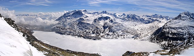
Deutsch: Stausee bei Val Cenis / Mont Cenis
Français : Vue aérienne du plateau du Mont-Cenis/Ambin. |
| Date | |
| Source | Own work (Original text: Eigene Aufnahme) |
| Author | Leonidas (Christian Georg Becker) |
| Camera location | | View this and other nearby images on: OpenStreetMap |
|---|
Licensing
edit
| |
This work has been released into the public domain by its author, Leonidas, at the English Wikipedia project. This applies worldwide. In case this is not legally possible: |
Original upload log
edit
Transferred from de.wikipedia to Commons by Lukas9950 using CommonsHelper.
The original description page was here. All following user names refer to de.wikipedia.
- 2009-11-07 01:49 Leonidas 4721×1364× (3792973 bytes) {{Information |Beschreibung = Stausee bei Val Cenis / Mont Cenis |Quelle = |Urheber = Christian Georg Becker |Datum = 25.Mar 2005 |Genehmigung = |Andere Versionen = http://static.panoramio.com/photos/original/7121313.jpg |Anmerkungen = Mir unbekannt, ob
| Annotations | This image is annotated: View the annotations at Commons |
File history
Click on a date/time to view the file as it appeared at that time.
| Date/Time | Thumbnail | Dimensions | User | Comment | |
|---|---|---|---|---|---|
| current | 12:54, 1 January 2010 | 4,721 × 1,364 (3.62 MB) | File Upload Bot (Magnus Manske) (talk | contribs) | {{BotMoveToCommons|de.wikipedia|year={{subst:CURRENTYEAR}}|month={{subst:CURRENTMONTHNAME}}|day={{subst:CURRENTDAY}}}} {{Information |Description={{de|Stausee bei Val Cenis / Mont Cenis}} |Source=Transferred from [http://de.wikipedia.org de.wikipedia]; t |
You cannot overwrite this file.
File usage on Commons
The following page uses this file:
File usage on other wikis
The following other wikis use this file:
- Usage on de.wikipedia.org
- Usage on en.wikipedia.org
- Usage on fr.wikipedia.org
- Usage on it.wikipedia.org
- Usage on nl.wikipedia.org
- Usage on pl.wikipedia.org