File:Valence, Bourg-lès-Valence et l'Ile aux Lapins - Carte postale - Début XXe siècle.jpg

Size of this preview: 800 × 514 pixels. Other resolutions: 320 × 206 pixels | 640 × 411 pixels | 1,024 × 658 pixels | 1,280 × 823 pixels | 1,774 × 1,140 pixels.
Original file (1,774 × 1,140 pixels, file size: 396 KB, MIME type: image/jpeg)
Captions
Captions
Add a one-line explanation of what this file represents
Summary
edit
| Description |
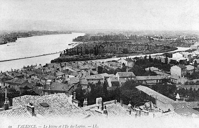
Français : Vue générale depuis la haute ville de Valence. On voit en contrebas la ville de Bourg-lès-Valence et l'Ile aux Lapins (actuel Ile Parc Girodet). Le bras oriental du Rhône a été depuis asséché. C'est le lieu de passage de l'autoroute A7 (E15). |
| Date | |
| Source | Own work |
| Author | Johanboss |
Licensing
edit
I, the copyright holder of this work, hereby publish it under the following license:
This file is licensed under the Creative Commons Attribution-Share Alike 4.0 International license.
- You are free:
- to share – to copy, distribute and transmit the work
- to remix – to adapt the work
- Under the following conditions:
- attribution – You must give appropriate credit, provide a link to the license, and indicate if changes were made. You may do so in any reasonable manner, but not in any way that suggests the licensor endorses you or your use.
- share alike – If you remix, transform, or build upon the material, you must distribute your contributions under the same or compatible license as the original.
File history
Click on a date/time to view the file as it appeared at that time.
| Date/Time | Thumbnail | Dimensions | User | Comment | |
|---|---|---|---|---|---|
| current | 14:06, 2 February 2024 | | 1,774 × 1,140 (396 KB) | Johanboss (talk | contribs) | Uploaded while editing "Bourg-lès-Valence" on fr.wikipedia.org |
You cannot overwrite this file.
File usage on Commons
There are no pages that use this file.
File usage on other wikis
The following other wikis use this file:
- Usage on fr.wikipedia.org