File:Velké Karlovice na mapě ČR.png
No higher resolution available.
Velké_Karlovice_na_mapě_ČR.png (256 × 150 pixels, file size: 9 KB, MIME type: image/png)
Captions
Captions
Add a one-line explanation of what this file represents
Summary
edit
| Description |
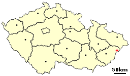
Čeština: Velké Karlovice(okres Vsetín) na mapě České republiky |
| Date | 30 June 2006 (original upload date) |
| Source | Image:Location of Czech village Mikuluvka.png; Originally from cs.wikipedia; description page is/was here. |
| Author | Original uploader and source image editor was Pkotrla at cs.wikipedia |
Licensing
edit
| |
This work has been released into the public domain by its author, Pkotrla, at the English Wikipedia project. This applies worldwide. In case this is not legally possible: |
Original upload log
edit
(All user names refer to cs.wikipedia)
- 2006-06-30 18:44 Pkotrla 256×150×8 (9336 bytes) Horní Bečva (okres Vsetín) na mapě České republiky z PD obrázku Location of Czech village Mikuluvka.png vytvořil [[Wikipedista:Pkotrla|Pkotrla]] == Licence == {{PD-self}}
File history
Click on a date/time to view the file as it appeared at that time.
| Date/Time | Thumbnail | Dimensions | User | Comment | |
|---|---|---|---|---|---|
| current | 07:28, 22 February 2008 | | 256 × 150 (9 KB) | Timichal (talk | contribs) | {{Information |Description={{cs|Velké Karlovice(okres Vsetín) na mapě České republiky z PD obrázku Location of Czech village Mikuluvka.png vytvořil Pkotrla}} |Source=Originally from [http://cs.wikipedia.org cs.wikipedi |
You cannot overwrite this file.
File usage on Commons
There are no pages that use this file.
File usage on other wikis
The following other wikis use this file:
- Usage on sk.wikipedia.org