File:Vermillion Cliffs NM (9407040668).jpg

Original file (5,616 × 3,744 pixels, file size: 9.25 MB, MIME type: image/jpeg)
Captions
Captions
Summary edit
.jpg&action=edit§ion=1)
| Description |
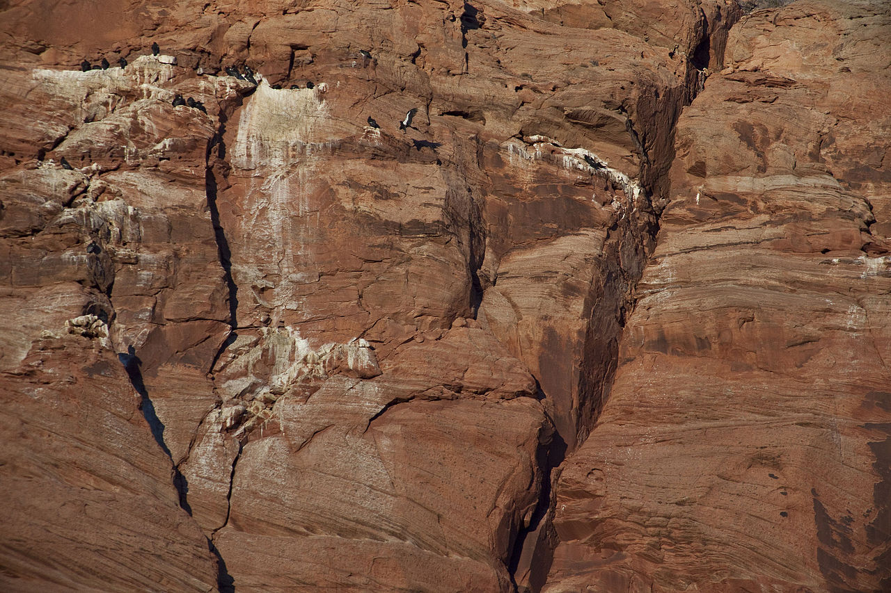
Located on the Colorado Plateau in northern Arizona, Vermilion Cliffs National Monument includes the Paria Canyon-Vermilion Cliffs Wilderness. The Monument borders Kaibab National Forest to the west and Glen Canyon National Recreation Area to the east. This remote and unspoiled, 280,000-acre Monument is a geologic treasure, containing a variety of diverse landscapes from the Paria Plateau, Vermilion Cliffs, Coyote Buttes, and Paria Canyon. Elevations range from 3,100 to 7,100 feet. Visitors will enjoy scenic views of towering cliffs and deep canyons. Paria Canyon offers an outstanding three to five day wilderness backpacking experience. The colorful swirls of cross-bedded sandstone in Coyote Buttes are an international hiking destination. There are also opportunities to view wildlife, including California condors. There are two developed campgrounds just outside the Monument: Stateline and White House. Dispersed camping is allowed outside the wilderness area in previously disturbed areas. A permit is required for hiking in Coyote Buttes North (the Wave), Coyote Buttes South, and for overnight trips within Paria Canyon. Learn more at: www.blm.gov/az/st/en/prog/blm_special_areas/natmon/vermil... Photo: Bob Wick, BLM California |
| Date | |
| Source | Vermillion Cliffs NM |
| Author | Bureau of Land Management |
Licensing edit
.jpg&action=edit§ion=2)
- You are free:
- to share – to copy, distribute and transmit the work
- to remix – to adapt the work
- Under the following conditions:
- attribution – You must give appropriate credit, provide a link to the license, and indicate if changes were made. You may do so in any reasonable manner, but not in any way that suggests the licensor endorses you or your use.
| This image was originally posted to Flickr by mypubliclands at https://flickr.com/photos/91981596@N06/9407040668. It was reviewed on 5 August 2015 by FlickreviewR and was confirmed to be licensed under the terms of the cc-by-2.0. |
| This image is a work of a Bureau of Land Management* employee, taken or made as part of that person's official duties. As a work of the U.S. federal government, the image is in the public domain in the United States. *or predecessor organization |
File history
Click on a date/time to view the file as it appeared at that time.
| Date/Time | Thumbnail | Dimensions | User | Comment | |
|---|---|---|---|---|---|
| current | 20:35, 4 August 2015 | | 5,616 × 3,744 (9.25 MB) | Wilfredor (talk | contribs) | Transferred from Flickr via Flickr2Commons |
You cannot overwrite this file.
File usage on Commons
There are no pages that use this file.
.jpg&oldid=454268250)