File:Vestfold2020.jpg
Size of this preview: 385 × 600 pixels. Other resolutions: 154 × 240 pixels | 610 × 950 pixels.
Original file (610 × 950 pixels, file size: 275 KB, MIME type: image/jpeg)
Captions
Captions
Add a one-line explanation of what this file represents
Summary
edit
| Description |
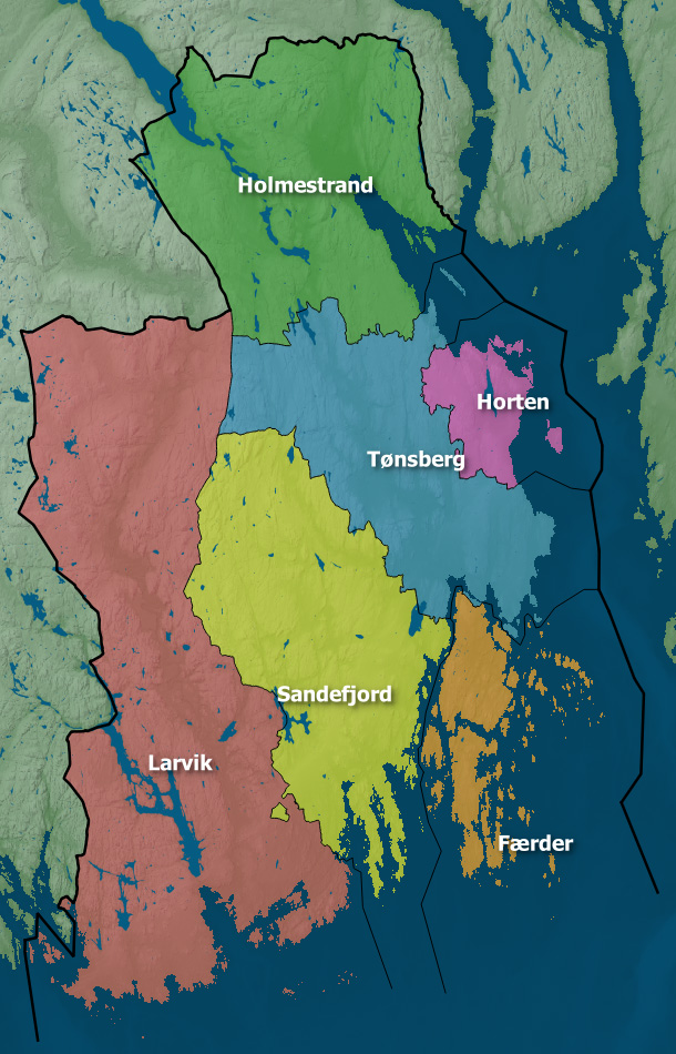
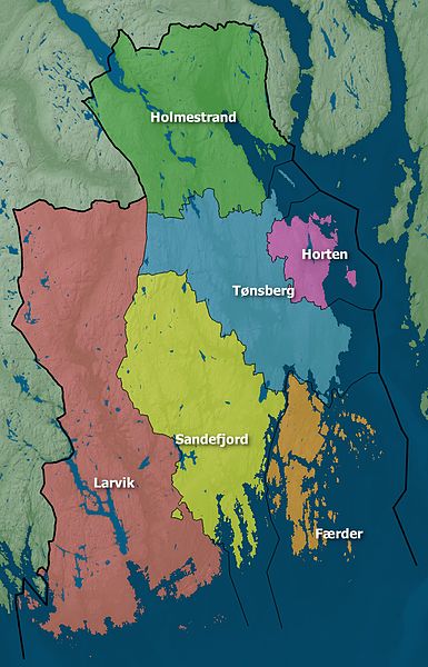
Norsk bokmål: Kommunestrukturen i Vestfold slik den kan bli fra 2020, basert på foreslåtte og vedtatte kommunesammenslåinger. Svelvik blir en del av Buskerud. Grensejusteringer kan forekomme, derfor er ikke kartet nøyaktig. Muligens vil Vestfold slås sammen med andre fylker til en ny region.
English: Planned municipalities in Vestfold, Norway from year 2020. Borders may be adjusted, so this is not an exact map. |
| Date | |
| Source | Own work |
| Author | Peter Fiskerstrand |
Licensing
edit
I, the copyright holder of this work, hereby publish it under the following license:
This file is licensed under the Creative Commons Attribution-Share Alike 4.0 International license.
- You are free:
- to share – to copy, distribute and transmit the work
- to remix – to adapt the work
- Under the following conditions:
- attribution – You must give appropriate credit, provide a link to the license, and indicate if changes were made. You may do so in any reasonable manner, but not in any way that suggests the licensor endorses you or your use.
- share alike – If you remix, transform, or build upon the material, you must distribute your contributions under the same or compatible license as the original.
File history
Click on a date/time to view the file as it appeared at that time.
| Date/Time | Thumbnail | Dimensions | User | Comment | |
|---|---|---|---|---|---|
| current | 15:22, 3 January 2017 | | 610 × 950 (275 KB) | PeterFisk (talk | contribs) | User created page with UploadWizard |
You cannot overwrite this file.
File usage on Commons
There are no pages that use this file.
File usage on other wikis
The following other wikis use this file:
- Usage on no.wikipedia.org
- Usage on sv.wikipedia.org