File:Vialikaje Kniastva Litoŭskaje. Вялікае Княства Літоўскае (G. Mercator, 1554).jpg

Size of this preview: 404 × 600 pixels. Other resolutions: 161 × 240 pixels | 323 × 480 pixels | 1,010 × 1,500 pixels.
Original file (1,010 × 1,500 pixels, file size: 626 KB, MIME type: image/jpeg)
Captions
Captions
Add a one-line explanation of what this file represents
Summary edit
.jpg&action=edit§ion=1)
| Description |
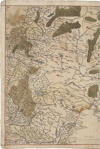
Беларуская (тарашкевіца): Вялікае Княства Літоўскае (Vialikaje Kniastva Litoŭskaje). Мапа |
| Date | |
| Source |
The Mercator Atlas of Europe. P. 93. British Library Maps C.29.c.13 |
| Author | Gerardus Mercator |
Licensing edit
.jpg&action=edit§ion=2)
|
This work is in the public domain in its country of origin and other countries and areas where the copyright term is the author's life plus 100 years or fewer. | |
| This file has been identified as being free of known restrictions under copyright law, including all related and neighboring rights. | |
File history
Click on a date/time to view the file as it appeared at that time.
| Date/Time | Thumbnail | Dimensions | User | Comment | |
|---|---|---|---|---|---|
| current | 10:06, 3 September 2021 | | 1,010 × 1,500 (626 KB) | Kazimier Lachnovič (talk | contribs) | fix |
| 09:54, 3 September 2021 |  | 1,010 × 1,500 (319 KB) | Kazimier Lachnovič (talk | contribs) | == {{int:filedesc}} == {{Information |Description ={{be-tarask|1=Вялікае Княства Літоўскае (Vialikaje Kniastva Litoŭskaje). Мапа}} |Source =The Mercator Atlas of Europe. P. 93. <br> British Library Maps C.29.c.13 |Date =1554 |Author =Gerardus Mercator |other_versions= }} == {{int:license-header}} == {{PD-old-100}} Category:Old maps of the Grand Duchy of Lithuania Category:1630 maps of Lithuania [[Category:Maps by Gera... |
You cannot overwrite this file.
File usage on Commons
The following 5 pages use this file:
.jpg)
.jpg)
.jpg)
.jpg)
.jpg)
.jpg&oldid=856916802)