File:Vido map-British fortresses.jpg
Vido_map-British_fortresses.jpg (600 × 443 pixels, file size: 166 KB, MIME type: image/jpeg)
Captions
Captions
| Description |
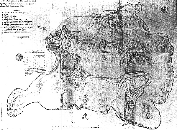
English: Vido island, Corfu, plans for british fortifications after 1814 |
||||
| Date | circa 1814 | ||||
| Source | www.corfu.gr/Hellas/tourismos/vido2.htm | ||||
| Author | J.W. Worsley (architect) | ||||
| Permission (Reusing this file) |
|
||||
File history
Click on a date/time to view the file as it appeared at that time.
| Date/Time | Thumbnail | Dimensions | User | Comment | |
|---|---|---|---|---|---|
| current | 23:48, 30 December 2008 | | 600 × 443 (166 KB) | Pitichinaccio (talk | contribs) | {{Information |Description={{en|1=Vido island, Corfu, plans for british fortifications after 1814}} |Source=www.corfu.gr/Hellas/tourismos/vido2.htm |Author=J.W. Worsley (architect) |Date=~1814 |Permission={{PD-old}} |other_versions= }} <!--{{ImageUpload| |
You cannot overwrite this file.
File usage on Commons
There are no pages that use this file.
File usage on other wikis
The following other wikis use this file:
- Usage on de.wikipedia.org
- Usage on es.wikipedia.org