File:View of Te Motu o Poutoa (Anzac Park - Pork Chop Hill), 1986.png

Size of this preview: 800 × 536 pixels. Other resolutions: 320 × 215 pixels | 640 × 429 pixels | 1,024 × 687 pixels | 1,280 × 858 pixels | 2,957 × 1,983 pixels.
Original file (2,957 × 1,983 pixels, file size: 7.5 MB, MIME type: image/png)
Captions
Captions
Add a one-line explanation of what this file represents
Summary
edit,_1986.png&action=edit§ion=1)
| Description |
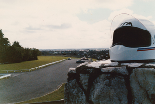
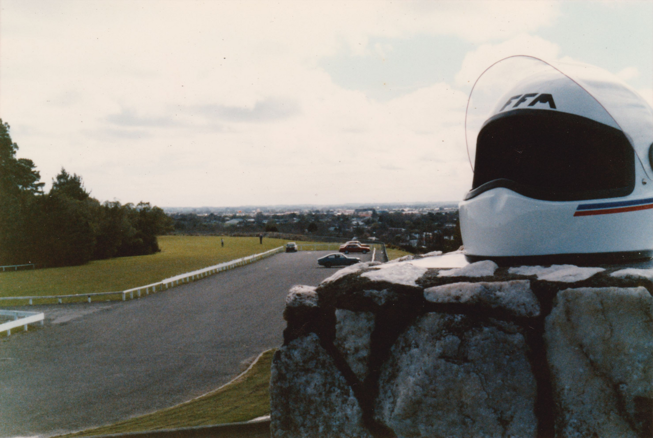
English: This picture shows the carpark at the park, the green space, and the Palmerston North skyline. The park was originally a Pa, whose terraces were demolished in the c.1960s for soil to fill gulleys in the area for housing development. |
| Date | |
| Source | https://manawatuheritage.pncc.govt.nz/item/a2ccfca4-6b51-4f3b-811b-69a4b5220366 |
| Author | David Foster |
Licensing
edit,_1986.png&action=edit§ion=2)
This file is licensed under the Creative Commons Attribution 4.0 International license.
- You are free:
- to share – to copy, distribute and transmit the work
- to remix – to adapt the work
- Under the following conditions:
- attribution – You must give appropriate credit, provide a link to the license, and indicate if changes were made. You may do so in any reasonable manner, but not in any way that suggests the licensor endorses you or your use.
File history
Click on a date/time to view the file as it appeared at that time.
| Date/Time | Thumbnail | Dimensions | User | Comment | |
|---|---|---|---|---|---|
| current | 02:55, 26 May 2022 | | 2,957 × 1,983 (7.5 MB) | Schwede66 (talk | contribs) | Uploaded a work by David Foster from https://manawatuheritage.pncc.govt.nz/item/a2ccfca4-6b51-4f3b-811b-69a4b5220366 with UploadWizard |
You cannot overwrite this file.
File usage on Commons
The following page uses this file:
File usage on other wikis
The following other wikis use this file:
- Usage on de.wikipedia.org
- Usage on www.wikidata.org
,_1986.png&oldid=658940626)