File:View of Teton Range, Idaho State Highway 33 Northeast of Rexburg, Idaho (1164645767).jpg

Original file (1,600 × 1,200 pixels, file size: 190 KB, MIME type: image/jpeg)
Captions
Captions
Summary edit
.jpg&action=edit§ion=1)
| Description |
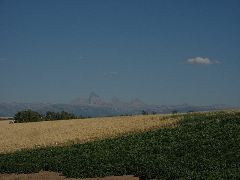
The Teton Range is a mountain range of the Rocky Mountains in North America. A north-south range, it is mostly on the Wyoming side of that state's border with Idaho, just south of Yellowstone National Park. Most of the east slope of the range is in Grand Teton National Park. Early French Voyageurs used the name les trois tétons (the three breasts). The principal summits of the central massif, sometimes referred to as the Cathedral Group, are Grand Teton (13,770 feet (4,200 m)), Mount Owen (12,928 feet (3,940 m)), Teewinot (12,325 feet (3,757 m)), Middle Teton (12,804 feet (3,903 m)) and South Teton (12,514 feet (3,814 m)). Other peaks in the range include Mount Moran (12,605 feet (3,842 m)), Mount Wister (11,490 feet (3,500 m)), Buck Mountain (11,938 feet (3,639 m)) and Static Peak (11,303 feet (3,445 m)). One reason the Teton Range is famous is because of the great elevation above the eastern side. Unlike most mountain ranges, the east side of the teton range lacks foothills, or lower peaks which can obscure the view. This is due to the Teton Fault at the base of the range on the eastern side, and the range being too young to have eroded into soft hills. The east slope of the Teton range rises sharply, from 5,000 to 7,000 feet above the valley floor. The view is most dramatic from the east; on the west side, the Teton range appears as high rolling hills that transition smoothly into flat pasture. <a href="http://en.wikipedia.org/wiki/Teton_Range" rel="nofollow">en.wikipedia.org/wiki/Teton_Range</a> en.wikipedia.org/wiki/Wikipedia:Text_of_Creative_Commons_... |
| Date | |
| Source | View of Teton Range, Idaho State Highway 33 Northeast of Rexburg, Idaho |
| Author | Ken Lund from Reno, Nevada, USA |
| Camera location | | View this and other nearby images on: OpenStreetMap |
|---|
.jpg¶ms=043.871740_N_-111.386690_E_globe:Earth_type:camera_source:Flickr_&language=en)
Licensing edit
.jpg&action=edit§ion=2)
- You are free:
- to share – to copy, distribute and transmit the work
- to remix – to adapt the work
- Under the following conditions:
- attribution – You must give appropriate credit, provide a link to the license, and indicate if changes were made. You may do so in any reasonable manner, but not in any way that suggests the licensor endorses you or your use.
- share alike – If you remix, transform, or build upon the material, you must distribute your contributions under the same or compatible license as the original.
| This image was originally posted to Flickr by Ken Lund at https://flickr.com/photos/75683070@N00/1164645767 (archive). It was reviewed on 23 June 2018 by FlickreviewR 2 and was confirmed to be licensed under the terms of the cc-by-sa-2.0. |
File history
Click on a date/time to view the file as it appeared at that time.
| Date/Time | Thumbnail | Dimensions | User | Comment | |
|---|---|---|---|---|---|
| current | 22:09, 23 June 2018 | | 1,600 × 1,200 (190 KB) | Hiàn (alt) (talk | contribs) | Transferred from Flickr via #flickr2commons |
You cannot overwrite this file.
File usage on Commons
There are no pages that use this file.
.jpg&oldid=575743006)