File:Virgin Islands regions map.svg

Size of this PNG preview of this SVG file: 455 × 599 pixels. Other resolutions: 182 × 240 pixels | 364 × 480 pixels | 583 × 768 pixels | 777 × 1,024 pixels | 1,555 × 2,048 pixels | 924 × 1,217 pixels.
Original file (SVG file, nominally 924 × 1,217 pixels, file size: 584 KB)
Captions
Captions
Add a one-line explanation of what this file represents

|
This file was moved to Wikimedia Commons from wts.oldwikivoyage using a bot script. All source information is still present. It requires review. Additionally, there may be errors in any or all of the information fields; information on this file should not be considered reliable and the file should not be used until it has been reviewed and any needed corrections have been made. Once the review has been completed, this template should be removed. For details about this file, see below. Check now! |
Summary
edit
| Description |
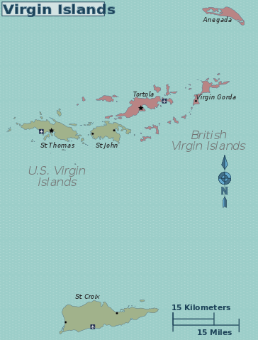
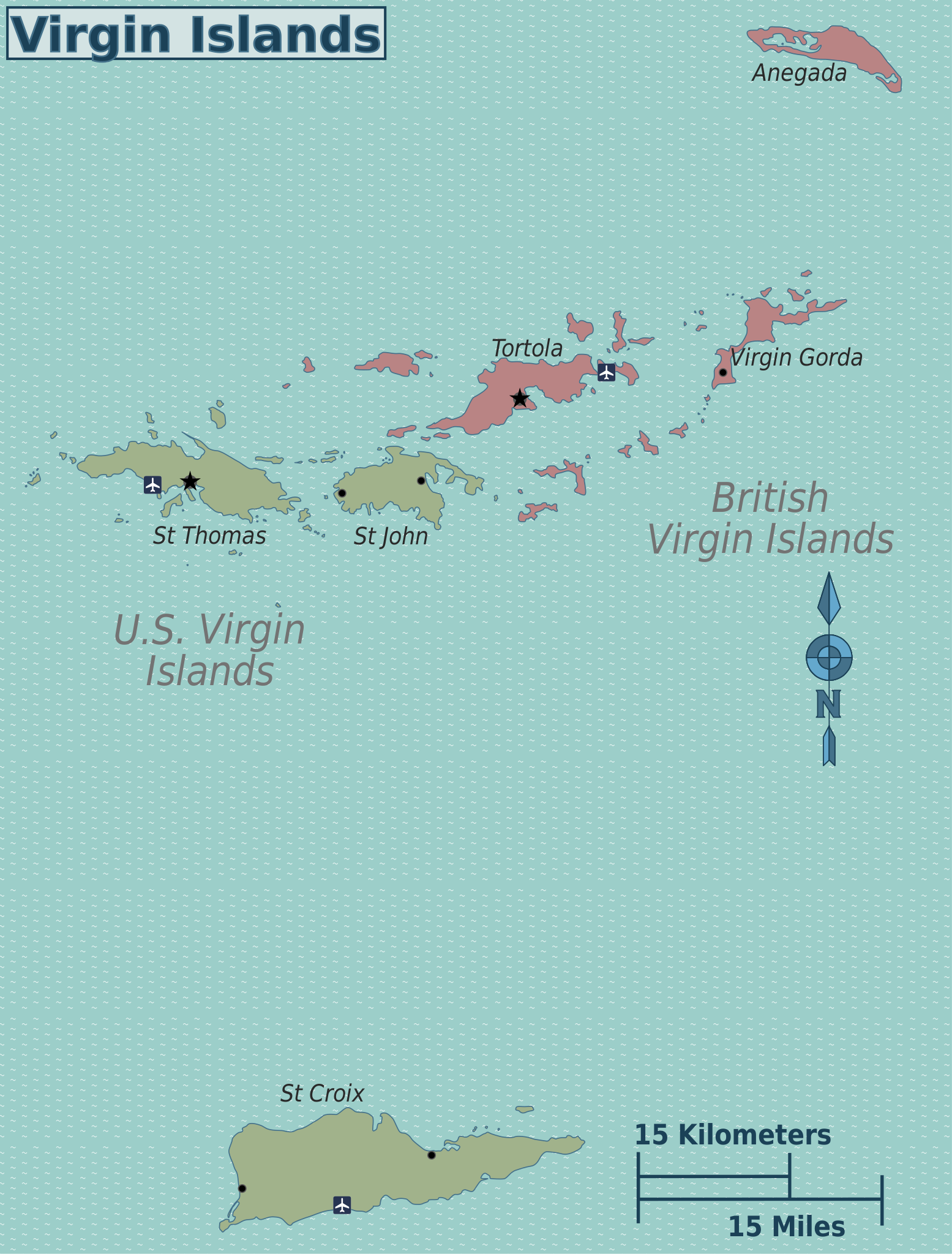
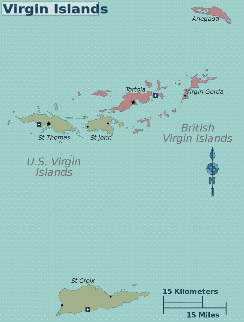
Virgin Islands regions map. SVG, Virgin Islands
SVG derivatives: PNG versions: |
| Date | |
| Source | [1] |
| Author | Peter Fitzgerald |
![[1]](http://www.lib.utexas.edu/maps/americas/virginislands.jpg)
Licensing
edit
| This work has been released into the public domain by its author, User: (WT-shared) Peterfitzgerald at wts wikivoyage. This applies worldwide. In some countries this may not be legally possible; if so: User: (WT-shared) Peterfitzgerald at wts wikivoyage grants anyone the right to use this work for any purpose, without any conditions, unless such conditions are required by law.
|
Original upload log
edit
| This file was imported from Wikivoyage WTS. |
The original description page was here. All following user names refer to wts.wikivoyage-old.
- 2010-07-19 21:56 (WT-shared) Peterfitzgerald archive copy at the Wayback Machine 924×1217 (597765 bytes) {{Imagecredit|credit=Peter Fitzgerald|captureDate=19 July 2010|location=Caribbean|source=[http://www.lib.utexas.edu/maps/americas/virginisla (Import from wikitravel.org/shared)
File history
Click on a date/time to view the file as it appeared at that time.
| Date/Time | Thumbnail | Dimensions | User | Comment | |
|---|---|---|---|---|---|
| current | 21:47, 17 November 2012 | | 924 × 1,217 (584 KB) | MGA73bot2 (talk | contribs) | {{BotMoveToCommons|wts.oldwikivoyage|year={{subst:CURRENTYEAR}}|month={{subst:CURRENTMONTHNAME}}|day={{subst:CURRENTDAY}}}} == {{int:filedesc}} == {{Information |description=Virgin Islands regions map. SVG, Virgin Islands * Map of: Virgin Islands¤ '''... |
You cannot overwrite this file.
File usage on Commons
There are no pages that use this file.