File:Vista Parcial De La Cindad Nueva(GN04866).jpg

Size of this preview: 800 × 600 pixels. Other resolutions: 320 × 240 pixels | 640 × 480 pixels | 1,024 × 768 pixels | 1,280 × 960 pixels | 2,560 × 1,920 pixels | 3,264 × 2,448 pixels.
Original file (3,264 × 2,448 pixels, file size: 1.49 MB, MIME type: image/jpeg)
Captions
Captions
Montevideo, Uruguay
Summary edit
.jpg&action=edit§ion=1)
| Vista Parcial De La Cindad Nueva | ||||
|---|---|---|---|---|
| Photographer |
State Government Photographer |
|||
| Title |
Vista Parcial De La Cindad Nueva |
|||
| Description |
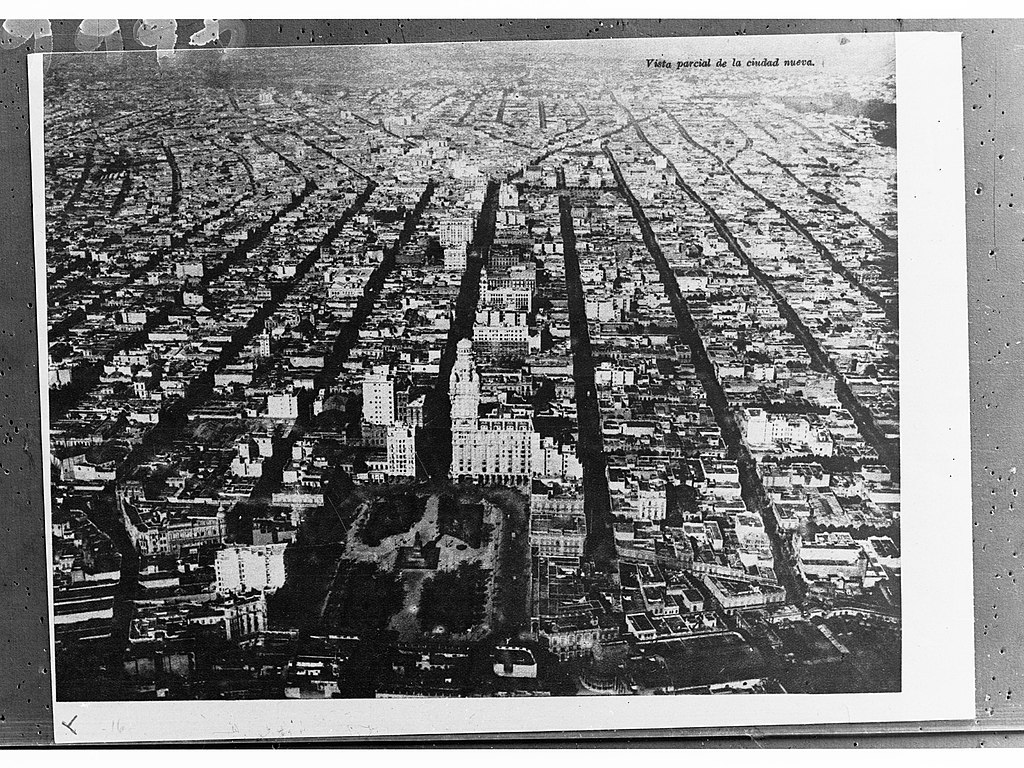
English: Aerial View of Montevideo, capital of Uruguay, with Plaza Independencia in the lower Center. View goes to the east. Deutsch: Luftaufnahme des Stadtzentrums von Montevideo, der Hauptstadt Uruguays. In der unteren Bildmitte ist die Plaza Independencia erkennbar; der Blick geht Richtung Osten. |
|||
| Date | circa 1915 | |||
| Medium | Glass Negatives | |||
| Collection | The History Trust of South Australia | |||
| Accession number |
GN04866 |
|||
| Source |
The History Trust of South Australian, South Australian Government Photo [1] Object record [2] |
|||
| Permission (Reusing this file) |
|
|||
Licensing edit
.jpg&action=edit§ion=2)
| This file is made available under the Creative Commons CC0 1.0 Universal Public Domain Dedication. | |
| The person who associated a work with this deed has dedicated the work to the public domain by waiving all of their rights to the work worldwide under copyright law, including all related and neighboring rights, to the extent allowed by law. You can copy, modify, distribute and perform the work, even for commercial purposes, all without asking permission.
|
| Camera location | | View this and other nearby images on: OpenStreetMap |
|---|
.jpg¶ms=-34.906900_N_-056.205810_E_globe:Earth_type:camera__&language=en)
| Object location | | View this and other nearby images on: OpenStreetMap |
|---|
.jpg¶ms=-34.906480_N_-056.198700_E_globe:Earth_class:object_type:object__&language=en)
File history
Click on a date/time to view the file as it appeared at that time.
| Date/Time | Thumbnail | Dimensions | User | Comment | |
|---|---|---|---|---|---|
| current | 06:01, 10 February 2020 | | 3,264 × 2,448 (1.49 MB) | Htsa (talk | contribs) | Image uploaded using Htsa Bot |
You cannot overwrite this file.
File usage on Commons
The following 2 pages use this file:
.jpg)
File usage on other wikis
The following other wikis use this file:
- Usage on de.wikipedia.org
.jpg&oldid=797613217)