File:Vnější Západní Karpaty, i.svg

Size of this PNG preview of this SVG file: 800 × 533 pixels. Other resolutions: 320 × 213 pixels | 640 × 427 pixels | 1,024 × 683 pixels | 1,280 × 853 pixels | 2,560 × 1,707 pixels | 999 × 666 pixels.
Original file (SVG file, nominally 999 × 666 pixels, file size: 99 KB)
Captions
Captions
Add a one-line explanation of what this file represents
Summary edit
| Description |
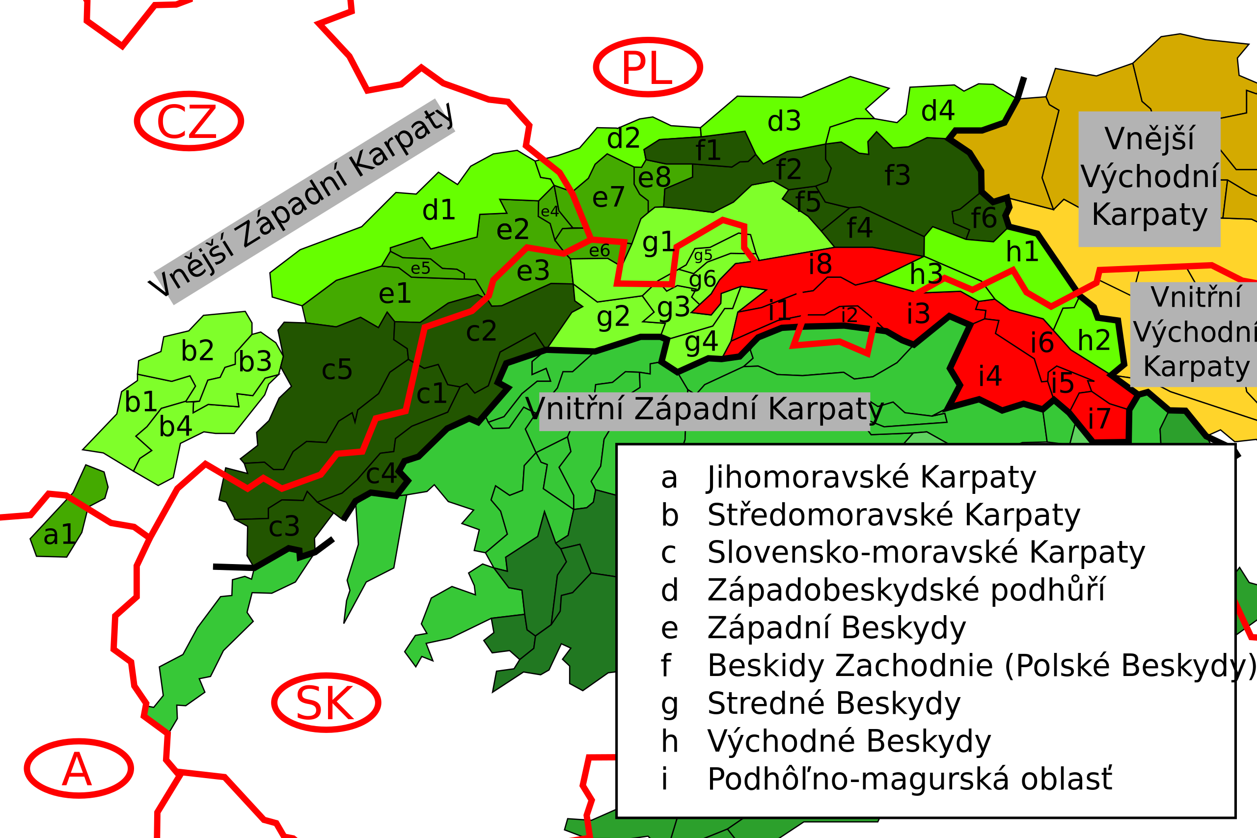
Čeština: Podhôľno-magurskou oblasť Slovenčina: Podhôľno-magurskou oblasť.
English: :Map of some Outer Western Carpathians ranges in the Podhale-Magura Area (Lesser Poland Voivodeship, Poland) and northern Slovakia. |
| Date | |
| Source | Created from Image:Divisions of the Carpathians.png |
| Author | Daniel Baránek |
| Permission (Reusing this file) |
This file is licensed under the Creative Commons Attribution-Share Alike 3.0 Unported license.
|
File history
Click on a date/time to view the file as it appeared at that time.
| Date/Time | Thumbnail | Dimensions | User | Comment | |
|---|---|---|---|---|---|
| current | 19:27, 17 March 2008 | | 999 × 666 (99 KB) | Daniel Baránek (talk | contribs) | == Popis == {{Information |Description={{cs|Podhôľno-magurskou oblasť}}{{sk|Podhôľno-magurskou oblasť}} |Source=Created from Image:Divisions of the Carpathians.png |Date= |
You cannot overwrite this file.
File usage on Commons
There are no pages that use this file.
File usage on other wikis
The following other wikis use this file:
- Usage on cs.wikipedia.org
- Usage on en.wikipedia.org
- Usage on hu.wikipedia.org
- Usage on sk.wikipedia.org