File:Volary seniky 1837.jpg

Size of this preview: 603 × 599 pixels. Other resolutions: 241 × 240 pixels | 483 × 480 pixels | 773 × 768 pixels | 1,030 × 1,024 pixels | 2,000 × 1,988 pixels.
Original file (2,000 × 1,988 pixels, file size: 1.39 MB, MIME type: image/jpeg)
Captions
Captions
Add a one-line explanation of what this file represents
Summary
edit
| Description |
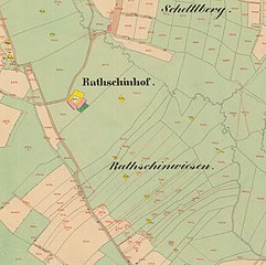
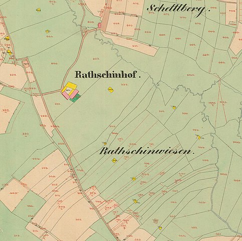
Čeština: Volarské seníky v okolí samoty Rathschinhof severozápadně od Volar. Stav v roce 1837, Císařské otisky mapy Stabilního katastru, výřez mapového listu 8752-1-020. |
| Date | |
| Source | Ústřední archiv zeměměřictví a katastru |
| Author | Anonymous |

|
This file was created on the basis of data provided by the Central Archives of Surveying and Land Register (State Administration of Land Surveying and Cadastre).
|

|
This file was obtained as part of the Editaton Volary project.
|
Licensing
edit
According to the Czech Copyright Act, this work is in the public domain.
(Law No. 121/2000, Article 3, Section a) “Protection pursuant to this Act shall not apply to
|
 |
File history
Click on a date/time to view the file as it appeared at that time.
| Date/Time | Thumbnail | Dimensions | User | Comment | |
|---|---|---|---|---|---|
| current | 10:01, 21 March 2020 | | 2,000 × 1,988 (1.39 MB) | Gampe (talk | contribs) | Uploaded a work by {{anonymous}} from [https://www.cuzk.cz/Urady/Zememericky-urad/Dalsi-informace/UAZK/Prohlizeni-archivalii,-archivni-mapy.aspx Ústřední archiv zeměměřictví a katastru] with UploadWizard |
You cannot overwrite this file.
File usage on Commons
There are no pages that use this file.
File usage on other wikis
The following other wikis use this file:
- Usage on cs.wikipedia.org