File:Voltlage Hilgenstieb 04.JPG
Size of this preview: 391 × 600 pixels. Other resolutions: 156 × 240 pixels | 313 × 480 pixels | 500 × 768 pixels | 667 × 1,024 pixels | 1,335 × 2,048 pixels | 3,151 × 4,834 pixels.
Original file (3,151 × 4,834 pixels, file size: 7.8 MB, MIME type: image/jpeg)
Captions
Captions
Add a one-line explanation of what this file represents
Summary
edit
| Description |
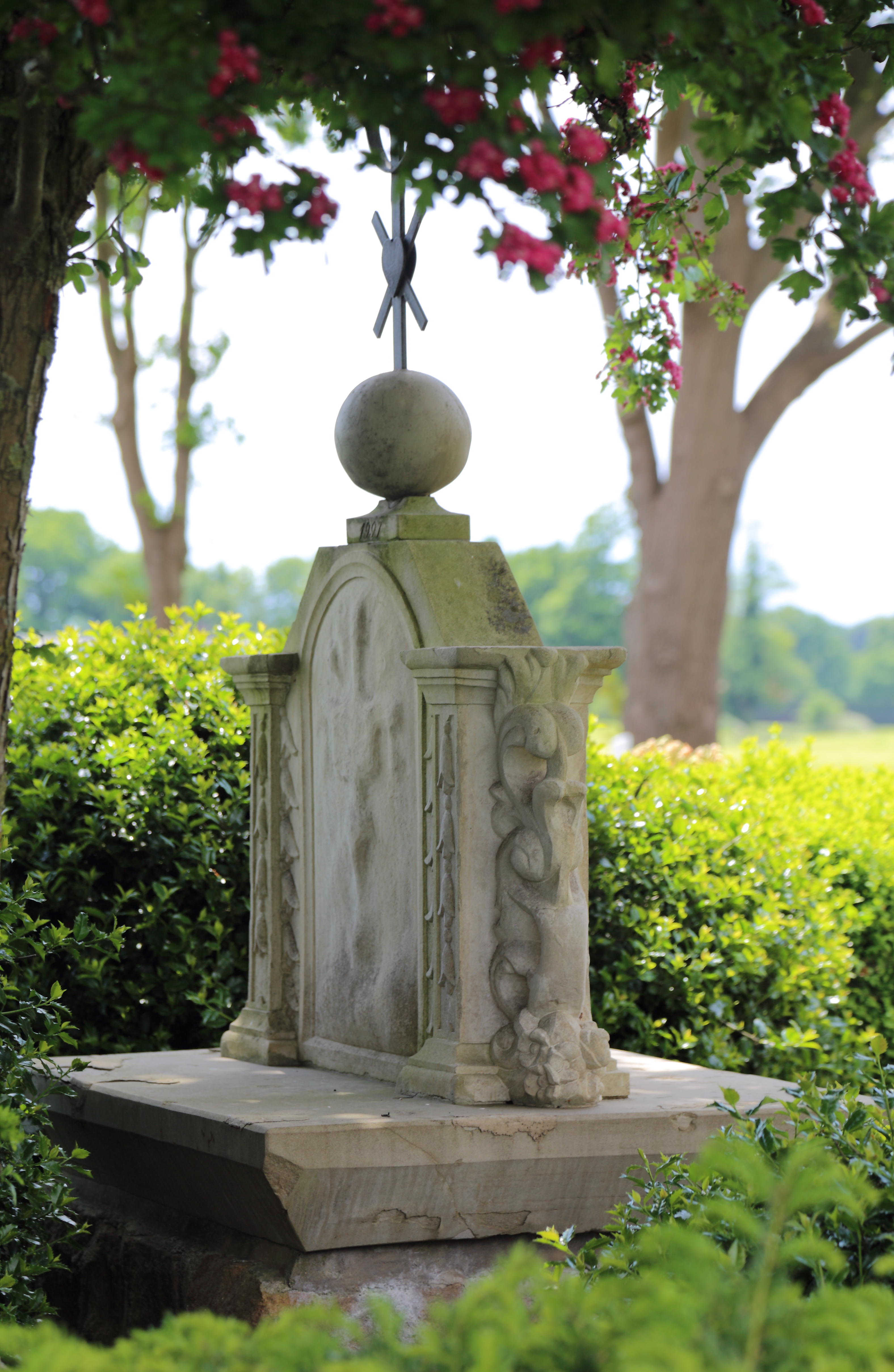
English: The Hilgenstieb, a wayside shrine between Voltlage and Höckel, Samtgemeinde Neuenkirchen, Landkreis Osnabrück, Lower Saxony, Germany. The shrine with a relief depicting the Holy Family was erected in 1749 and restored in 1997.
Deutsch: Der Hilgenstieb (Heiligenbildstock) an der Fürstenauer Straße (Landesstraße 71)/Einmündung Bullenkamp an der früheren Grenze zwischen Höckel und Voltlage, Samtgemeinde Neuenkirchen, Landkreis Osnabrück, Niedersachsen, Deutschland. Der 1749 unweit des jetzigen Standorts am alten Höckeler Kirchweg aufgestellte Bildstock zeigt ein Relief der Heiligen Familie auf Wanderschaft. Nachdem der Kirchweg im Zuge der Flurbereinigung untergepflügt worden war, erhielt das Bildnis seinen neuen Standort. Im Lauf der Zeit stark verwittert, wurde es 1997 durch den Fürstenauer Bildhauer Heinz Stall restauriert. Da es keine konkreten Zeugnisse darüber gibt, warum der Bildstock seinerzeit aufgestellt worden war, ranken sich darum einige Sagen, vor allem diejenigen von einem früheren Grenzstreit mit tödlichem Ausgang zwischen Höckeler und Voltlager Bauern. |
| Date | |
| Source | Own work |
| Author | J.-H. Janßen |
| Camera location | | View this and other nearby images on: OpenStreetMap |
|---|
Licensing
edit
I, the copyright holder of this work, hereby publish it under the following licenses:

|
Permission is granted to copy, distribute and/or modify this document under the terms of the GNU Free Documentation License, Version 1.2 or any later version published by the Free Software Foundation; with no Invariant Sections, no Front-Cover Texts, and no Back-Cover Texts. A copy of the license is included in the section entitled GNU Free Documentation License. |
This file is licensed under the Creative Commons Attribution-Share Alike 3.0 Unported, 2.5 Generic, 2.0 Generic and 1.0 Generic license.
- You are free:
- to share – to copy, distribute and transmit the work
- to remix – to adapt the work
- Under the following conditions:
- attribution – You must give appropriate credit, provide a link to the license, and indicate if changes were made. You may do so in any reasonable manner, but not in any way that suggests the licensor endorses you or your use.
- share alike – If you remix, transform, or build upon the material, you must distribute your contributions under the same or compatible license as the original.
You may select the license of your choice.
File history
Click on a date/time to view the file as it appeared at that time.
| Date/Time | Thumbnail | Dimensions | User | Comment | |
|---|---|---|---|---|---|
| current | 21:24, 16 June 2015 | | 3,151 × 4,834 (7.8 MB) | J.-H. Janßen (talk | contribs) | {{Information |Description={{en|1=The ''Hilgenstieb'', a wayside shrine between Voltlage and Höckel, Samtgemeinde Neuenkirchen, Landkreis Osnabrück, Lower Saxony, Germany. It depicts the Holy Family and was errected in 1749 and restored i... |
You cannot overwrite this file.
File usage on Commons
There are no pages that use this file.