File:Vyborg Castle - panoramio (5).jpg

Size of this preview: 600 × 600 pixels. Other resolutions: 240 × 240 pixels | 480 × 480 pixels | 768 × 768 pixels | 1,024 × 1,024 pixels | 2,048 × 2,048 pixels | 4,616 × 4,616 pixels.
Original file (4,616 × 4,616 pixels, file size: 8.54 MB, MIME type: image/jpeg)
Captions
Captions
Add a one-line explanation of what this file represents
Summary
edit.jpg&action=edit§ion=1)
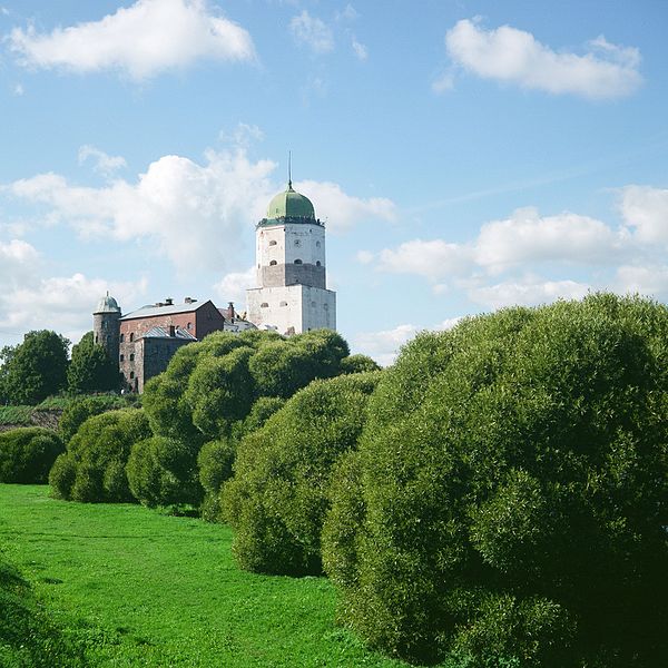
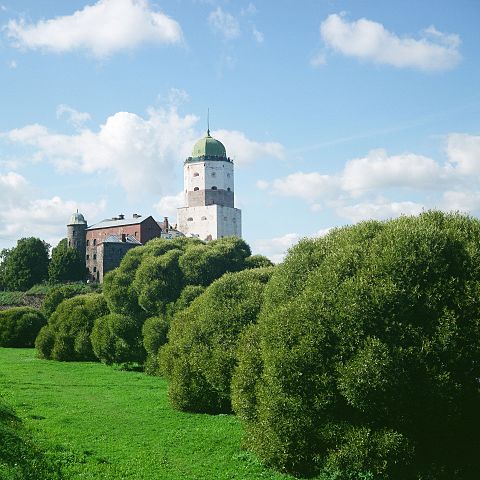
| Description | Vyborg Castle | ||
| Date | Taken on 6 September 2014 | ||
| Source | https://web.archive.org/web/20161103002939/http://www.panoramio.com/photo/113462595 | ||
| Author | Alexey Komarov | ||
| Permission (Reusing this file) |
This file is licensed under the Creative Commons Attribution 3.0 Unported license. Attribution: Alexey Komarov
|
||
| Panoramio Tags | Vyborg, 2014, Russia, Saint Petersburg, Vyborg |
| Camera location | | View this and other nearby images on: OpenStreetMap |
|---|
.jpg¶ms=060.715122_N_0028.733121_E_globe:Earth_type:camera_source:Panoramio_&language=en)
File history
Click on a date/time to view the file as it appeared at that time.
| Date/Time | Thumbnail | Dimensions | User | Comment | |
|---|---|---|---|---|---|
| current | 03:11, 7 May 2017 | | 4,616 × 4,616 (8.54 MB) | Panoramio upload bot (talk | contribs) | == {{int:filedesc}} == {{Information |description=Vyborg Castle |date={{Taken on|2014-11-02}} |source=http://www.panoramio.com/photo/113462595 |author=[http://www.panoramio.com/user/1770775?with_photo_id=113462595 Alexey Komarov] |permission={{cc-by-3.... |
You cannot overwrite this file.
File usage on Commons
There are no pages that use this file.
File usage on other wikis
The following other wikis use this file:
- Usage on ru.wikipedia.org
.jpg&oldid=622081859)