File:Vysočina obec, CZ180225-088.jpg

Size of this preview: 800 × 436 pixels. Other resolutions: 320 × 175 pixels | 640 × 349 pixels | 1,024 × 559 pixels | 1,280 × 698 pixels | 2,560 × 1,396 pixels | 4,891 × 2,668 pixels.
Original file (4,891 × 2,668 pixels, file size: 7.06 MB, MIME type: image/jpeg)
Captions
Captions
Add a one-line explanation of what this file represents
Summary
edit
| Description |
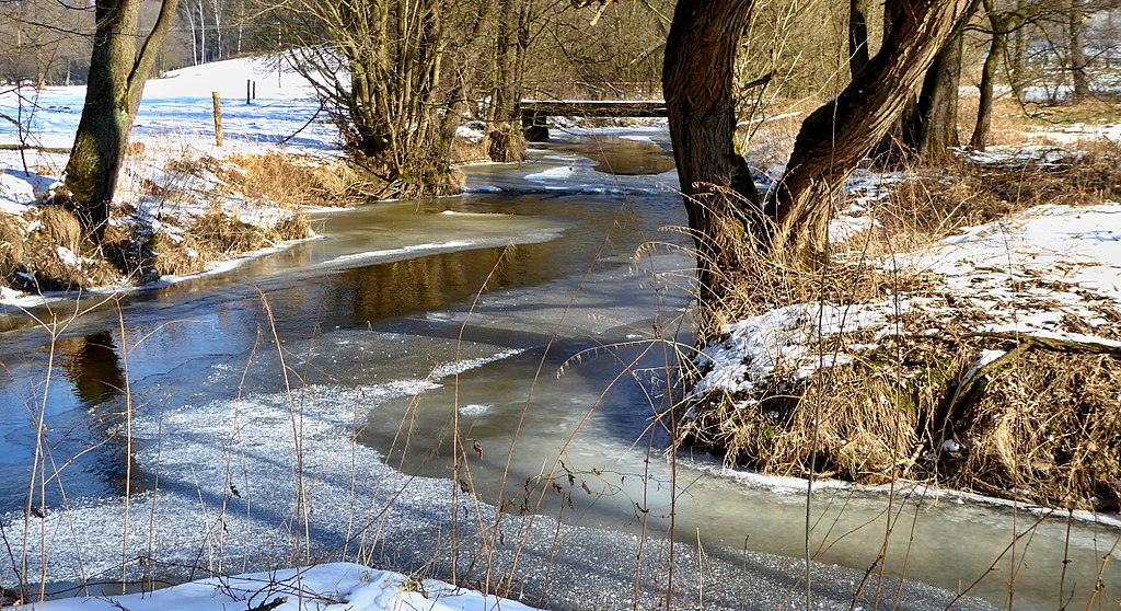
English: Confluence of Long brook with river Chrudimka (534 m asl) east of the top with name On Merry hill (czech: Na Veselém kopci, 579 m), on interface landscape areas "Stružinecká" knoll hill and "Kameničská" Highlands. Locality with meadows and pastures. The river (on the photo) on the cadastral area with the name Rváčov, wooden bridge in kilometer 78.2 above river Chrudimka, the river flows from the locality of "Králova Pila" (the hamlet of Milesimov). Photo location: Czechia, Pardubice Region, municipality Vysočina, the hamlet of Merry Hill (czech: Veselý Kopec), interface of geomorphological districts with names "Stružinecká" knoll hill and "Kameničská" Highlands.
Čeština: Soutok Dlouhého potoka s řekou Chrudimkou (534 m n. m.) východně od vrcholu Na Veselém Kopci (579 m), na rozhraní krajinných oblastí Stružinecké pahorkatiny a Kameničské vrchoviny. Lokalita s loukami a pastvinami. Řeka (na fotografii) na katastrálním území Rváčov, dřevěný most v kilometru 78,2 nad řekou Chrudimkou, přitéká z lokality Králova Pila (součást osady Milesimov).Foto lokace: Česko, Pardubický kraj, obec Vysočina, Veselý Kopec, rozhraní geomorfologických okrsků s názvy Stružinecká pahorkatina a Kameničské vrchovina, (20°). |
| Date | |
| Source | Own work |
| Author | Josef Kreuz (PEPan) |
| Permission (Reusing this file) |
I, the copyright holder of this work, hereby publish it under the following license: This file is licensed under the Creative Commons Attribution-Share Alike 4.0 International license.
|
| Camera location | | View this and other nearby images on: OpenStreetMap |
|---|
Zdroje informací:
edit
- ČÚZK, základní mapa ČR – kompozice: soutok Dlouhého potoka a řeky Chrudimky viz
- Mapy.cz, turistická mapa (letecký pohled) – kompozice Veselý Kopec viz
File history
Click on a date/time to view the file as it appeared at that time.
| Date/Time | Thumbnail | Dimensions | User | Comment | |
|---|---|---|---|---|---|
| current | 11:55, 28 February 2018 | | 4,891 × 2,668 (7.06 MB) | PEPan (talk | contribs) | User created page with UploadWizard |
You cannot overwrite this file.
File usage on Commons
There are no pages that use this file.
File usage on other wikis
The following other wikis use this file:
- Usage on cs.wikipedia.org
- Usage on www.wikidata.org