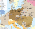
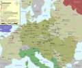
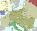
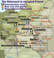
File:WW2 Holocaust Europe map-it.svg

Size of this PNG preview of this SVG file: 721 × 600 pixels. Other resolutions: 289 × 240 pixels | 577 × 480 pixels | 923 × 768 pixels | 1,231 × 1,024 pixels | 2,461 × 2,048 pixels | 1,310 × 1,090 pixels.
Original file (SVG file, nominally 1,310 × 1,090 pixels, file size: 550 KB)
File information
Structured data
Captions
Captions
Add a one-line explanation of what this file represents
Summary
edit| DescriptionWW2 Holocaust Europe map-it.svg |
Italiano: Mappa dell'Olocausto in Europa durante la Seconda Guerra Mondiale (1939-1945) |
| Date | |
| Source | |
| Author |
|
| Permission (Reusing this file) |
FAL. |
| Other versions |
[edit]
|
Licensing
edit| Copyleft: This work of art is free; you can redistribute it and/or modify it according to terms of the Free Art License. You will find a specimen of this license on the Copyleft Attitude site as well as on other sites. http://artlibre.org/licence/lal/enFALFree Art Licensefalsetrue |
This image was improved or created by the Wikigraphists of the Graphic Lab (it). You can propose images to clean up, improve, create or translate as well. |
Original upload log
editThe original description page was here. All following user names refer to it.wikipedia.
| Date/Time | Dimensions | User | Comment |
|---|---|---|---|
| 2014-01-30 21:21 | 1310×1090× (563187 bytes) | Mess | ulteriori aggiustamenti |
| 2014-01-30 10:26 | 1310×1090× (548988 bytes) | Mess | distinzione corretta tra campi di concentramento e campi di raccolta + correzioni minori |
| 2014-01-29 17:53 | 1310×1090× (497523 bytes) | Mess | {{Informazioni file |Descrizione = Mappa dell'Olocausto in Europa durante la Seconda Guerra Mondiale (1939-1945) |Fonte = *[[:File:WW2-Holocaust-Europe.png|WW2-Holocaust-Europe.png]] |Data = 29 gennaio 2014 |Autore = *[[:File:WW2-Holocaust-Europe.png|W... |
File history
Click on a date/time to view the file as it appeared at that time.
| Date/Time | Thumbnail | Dimensions | User | Comment | |
|---|---|---|---|---|---|
| current | 20:51, 2 February 2019 |  | 1,310 × 1,090 (550 KB) | Mess (talk | contribs) | Transferred from it.wikipedia via #commonshelper |
You cannot overwrite this file.
File usage on Commons
The following 25 pages use this file:
- User:Magog the Ogre/Maps of conflicts/2019 February
- File:WW2-Holocaust-Europe-2007Borders.png
- File:WW2-Holocaust-Europe-2007Borders DE.png
- File:WW2-Holocaust-Europe-he.png
- File:WW2-Holocaust-Europe.png
- File:WW2-Holocaust-Europe DE.png
- File:WW2-Holocaust-Europe DE 2.png
- File:WW2-Holocaust-Europe blank.png
- File:WW2-Holocaust-Poland-ru.png
- File:WW2-Holocaust-Poland-ukr.jpg
- File:WW2-Holocaust-Poland.PNG
- File:WW2-Holocaust-Poland (Français).png
- File:WW2-Holocaust-Poland (without comment).png
- File:WW2-Holocaust-Poland big legend.PNG
- File:WW2-Zagłada-Żydów-Polska.png
- File:WW2 Holocaust Europe N-E map-fr.svg
- File:WW2 Holocaust Europe map-blank.svg
- File:WW2 Holocaust Europe map-es.svg
- File:WW2 Holocaust Europe map-fr.svg
- File:WW2 Holocaust Europe map-it.svg
- File:WW2 Holocaust Europe map-pt.svg
- File:WW2 Holocaust Europe map-zh-hans.svg
- File:WW2 Holocaust Poland map-fr.svg
- File:Холокост в Европе.png
- Template:Other versions/WW2 Holocaust Europe map
File usage on other wikis
The following other wikis use this file:
- Usage on it.wikipedia.org
- Usage on it.wikibooks.org
Metadata
This file contains additional information such as Exif metadata which may have been added by the digital camera, scanner, or software program used to create or digitize it. If the file has been modified from its original state, some details such as the timestamp may not fully reflect those of the original file. The timestamp is only as accurate as the clock in the camera, and it may be completely wrong.
| Short title | Map of the Holocaust in Europe during World War II, 1939-1945. |
|---|---|
| Width | 1310 |
| Height | 1090 |


