File:WalesLocal2004.png
Size of this preview: 533 × 599 pixels. Other resolutions: 213 × 240 pixels | 427 × 480 pixels | 882 × 992 pixels.
Original file (882 × 992 pixels, file size: 18 KB, MIME type: image/png)
Captions
Captions
Add a one-line explanation of what this file represents
Summary
edit
| Description |
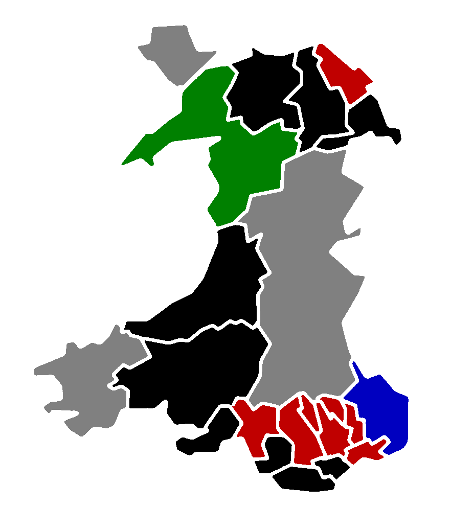
This is a map of the result of the 2004 local elections in Wales. This map shows all 22 unitary authorities colour-coded by their status after the election. Key: Labour control
Conservative control
Plaid Cymru control
Other control
|
| Date | |
| Source | Morwen's blank map of Wales; data is from the BBC |
| Author | Hoshie |
Licensing
edit

|
Permission is granted to copy, distribute and/or modify this document under the terms of the GNU Free Documentation License, Version 1.2 or any later version published by the Free Software Foundation; with no Invariant Sections, no Front-Cover Texts, and no Back-Cover Texts. A copy of the license is included in the section entitled GNU Free Documentation License. |
| This file is licensed under the Creative Commons Attribution-Share Alike 3.0 Unported license. | ||
| ||
| This licensing tag was added to this file as part of the GFDL licensing update. |
File history
Click on a date/time to view the file as it appeared at that time.
| Date/Time | Thumbnail | Dimensions | User | Comment | |
|---|---|---|---|---|---|
| current | 06:22, 22 May 2008 | | 882 × 992 (18 KB) | Hoshie (talk | contribs) | lighter shade of blue to help in scaling |
| 18:07, 7 May 2008 |  | 882 × 992 (41 KB) | Hoshie (talk | contribs) | {{Information |Description=This is a map of the result of the 2004 local elections in Wales. This map shows all 22 unitary authorities colour-coded by their status after the election. '''Key:''' {{legend|#C00000|Labour control}} {{legend|#000080|Conserv |
You cannot overwrite this file.
File usage on Commons
The following page uses this file: