File:Washington Presidential Election Results 1948.svg

Size of this PNG preview of this SVG file: 800 × 528 pixels. Other resolutions: 320 × 211 pixels | 640 × 423 pixels | 1,024 × 676 pixels | 1,280 × 845 pixels | 2,560 × 1,691 pixels | 810 × 535 pixels.
Original file (SVG file, nominally 810 × 535 pixels, file size: 61 KB)
Captions
Captions
Add a one-line explanation of what this file represents
Summary
edit
| Description |
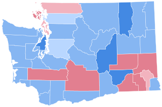
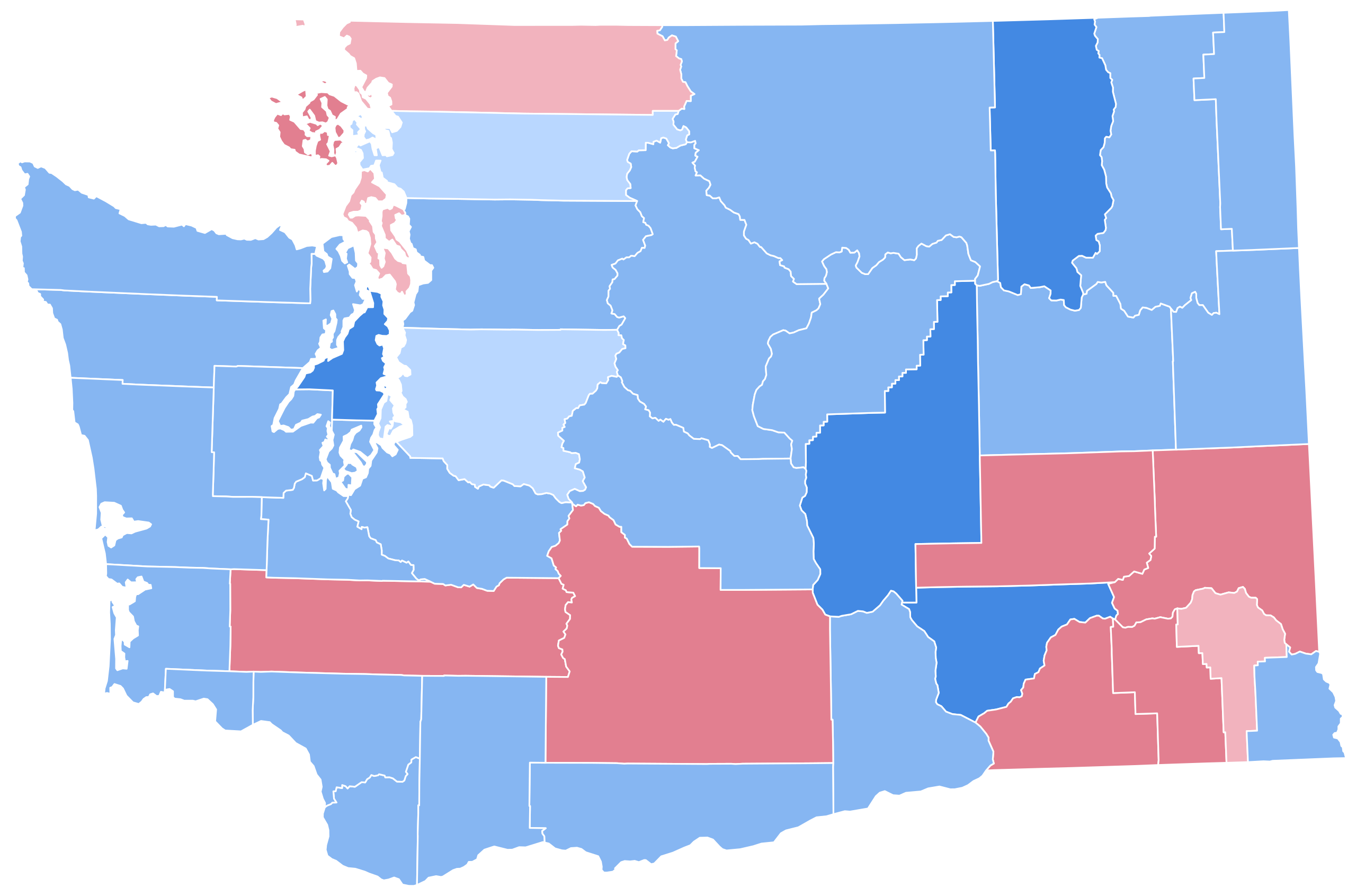
English: Map of County Results in U.S. Presidential Election in Washington, 1948 |
| Date | |
| Source | Own work |
| Author | SpeedMcCool |
Licensing
edit
I, the copyright holder of this work, hereby publish it under the following license:
This file is licensed under the Creative Commons Attribution-Share Alike 4.0 International license.
- You are free:
- to share – to copy, distribute and transmit the work
- to remix – to adapt the work
- Under the following conditions:
- attribution – You must give appropriate credit, provide a link to the license, and indicate if changes were made. You may do so in any reasonable manner, but not in any way that suggests the licensor endorses you or your use.
- share alike – If you remix, transform, or build upon the material, you must distribute your contributions under the same or compatible license as the original.
File history
Click on a date/time to view the file as it appeared at that time.
| Date/Time | Thumbnail | Dimensions | User | Comment | |
|---|---|---|---|---|---|
| current | 05:23, 20 June 2023 | | 810 × 535 (61 KB) | Putitonamap98 (talk | contribs) | shapes |
| 20:05, 29 June 2021 |  | 167 × 125 (17 KB) | TylerKutschbach (talk | contribs) | Fixed map | |
| 04:23, 25 July 2020 |  | 167 × 125 (17 KB) | TylerKutschbach (talk | contribs) | Better map. | |
| 19:47, 28 February 2019 |  | 156 × 103 (335 KB) | SpeedMcCool (talk | contribs) | User created page with UploadWizard |
You cannot overwrite this file.
File usage on Commons
The following 5 pages use this file:
File usage on other wikis
The following other wikis use this file:
- Usage on en.wikipedia.org