File:Washington State Route 131 (1971) topo.png

Size of this preview: 800 × 511 pixels. Other resolutions: 320 × 204 pixels | 640 × 409 pixels | 1,131 × 722 pixels.
Original file (1,131 × 722 pixels, file size: 1.84 MB, MIME type: image/png)
Captions
Captions
Add a one-line explanation of what this file represents
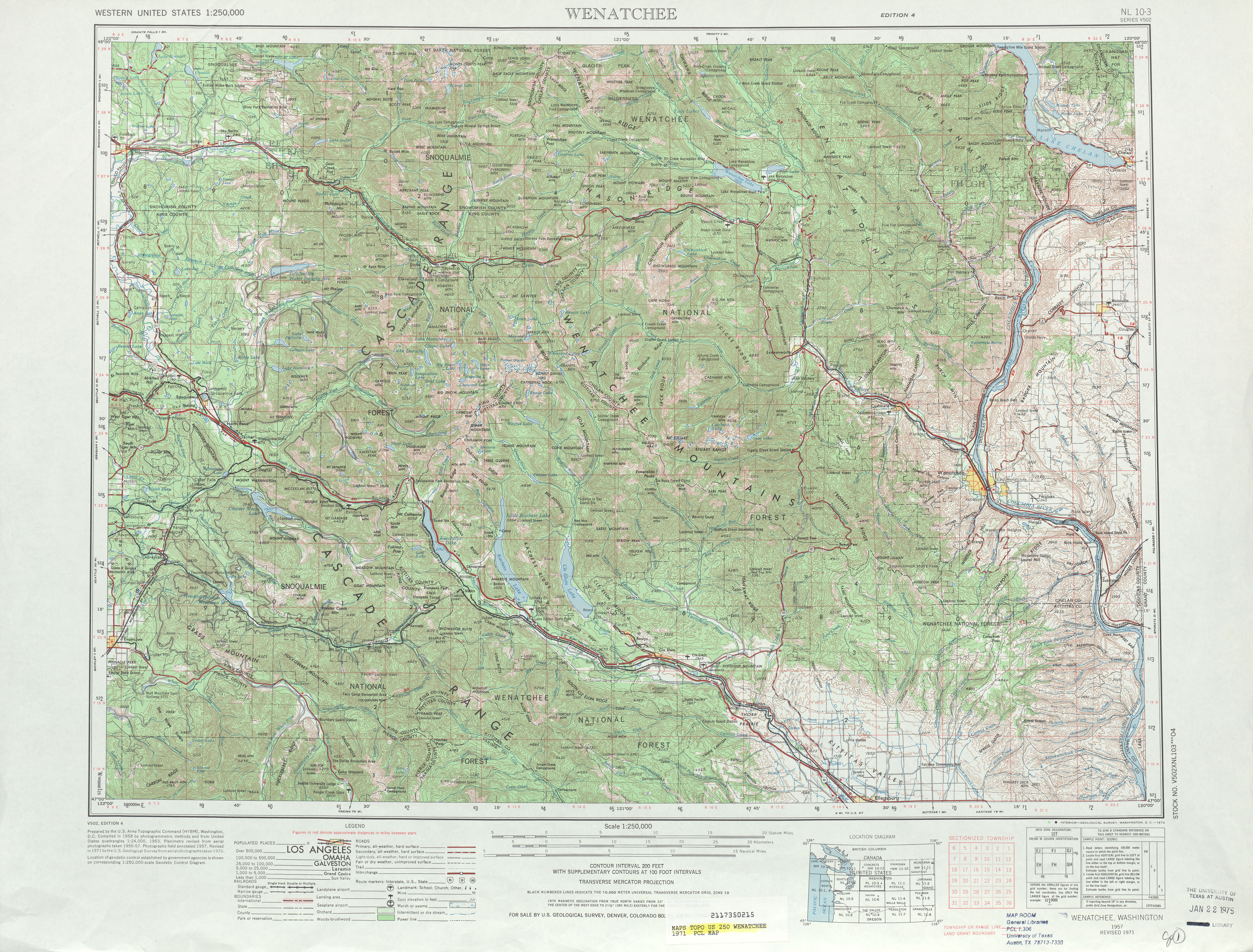
| Description | A 1971 USGS map showing the original route of Washington State Route 131, from Ellensburg to Virden, used from 1964 until 1975. | |||
| Date | ||||
| Source | Wenatchee, 1971 map | |||
| Author | United States Geological Survey | |||
| Permission (Reusing this file) |
|
File history
Click on a date/time to view the file as it appeared at that time.
| Date/Time | Thumbnail | Dimensions | User | Comment | |
|---|---|---|---|---|---|
| current | 23:45, 28 June 2009 | | 1,131 × 722 (1.84 MB) | ComputerGuy890100 (talk | contribs) | {{Information |Description=A 1971 USGS map showing the original route of w:Washington State Route 131, from Ellensburg to Virden, used from 1964 until 1975. |Source=[http://www.lib.utexas.edu/ |
You cannot overwrite this file.
File usage on Commons
There are no pages that use this file.
_topo.png&oldid=911226670)