File:Waterloo International Airport.PNG

Size of this preview: 800 × 472 pixels. Other resolutions: 320 × 189 pixels | 640 × 378 pixels | 1,287 × 760 pixels.
Original file (1,287 × 760 pixels, file size: 1.83 MB, MIME type: image/png)
Captions
Captions
Add a one-line explanation of what this file represents
Summary edit
| Description |
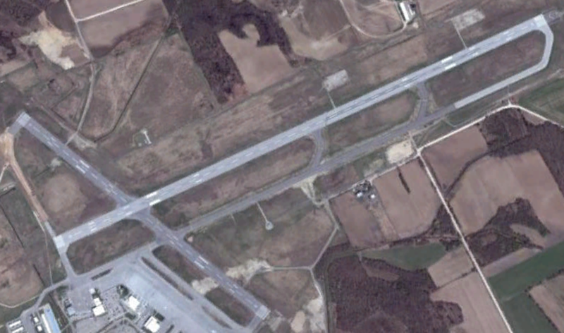
Deutsch: Satellitenbild des Flughafens English: Waterloo International Airport near Breslau, in Woolwich Township, Waterloo Region, Ontario, Canada. |
| Date | |
| Source | World Wind Application |
| Author | NASA |
Licensing edit
| This image is in the public domain because it is a screenshot from NASA’s globe software World Wind using a public domain layer, such as Blue Marble, MODIS, Landsat, SRTM, USGS or GLOBE.
|
 |
| Object location | | View this and other nearby images on: OpenStreetMap |
|---|
File history
Click on a date/time to view the file as it appeared at that time.
| Date/Time | Thumbnail | Dimensions | User | Comment | |
|---|---|---|---|---|---|
| current | 11:12, 8 January 2014 | | 1,287 × 760 (1.83 MB) | CarR (talk | contribs) | User created page with UploadWizard |
You cannot overwrite this file.
File usage on Commons
There are no pages that use this file.
File usage on other wikis
The following other wikis use this file:
- Usage on de.wikipedia.org