File:Watlington - geograph-3778354-by-Nigel-Cox.jpg
Watlington_-_geograph-3778354-by-Nigel-Cox.jpg (640 × 480 pixels, file size: 100 KB, MIME type: image/jpeg)
Captions
Captions
Summary
edit
| Description |
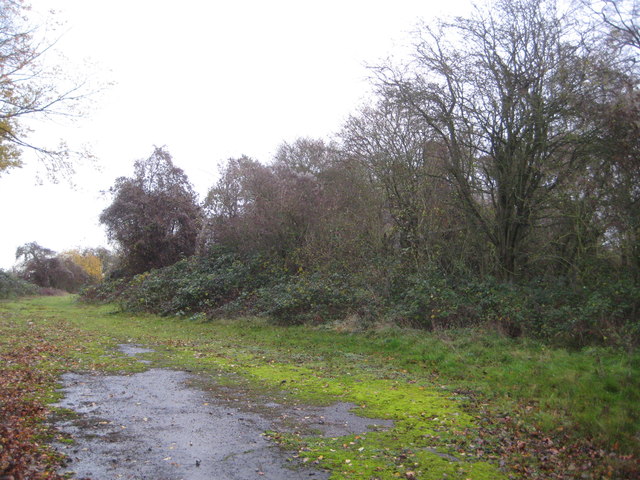
English: Pyrton: Former Watlington railway station (1) Just visible through the trees are the surviving chimney stacks of the otherwise derelict station building. The open area in front was the former approach to the station and its goods yard. This was the terminus of the single track line from Princes Risborough, opened in 1872 and closed here at least by British Railways in 1957. The section from Chinnor northwards to Princes Risborough remained open for the cement works traffic originally and remains open as a heritage railway today. It was originally intended to extend the line from Watlington to Wallingford to create a link between Cholsey on the Great Western Main Line and Princes Risborough, but the connection was never made because of financial constraints. The station is some way out of Watlington and actually in the neighbouring parish of Pyrton. If the connection to Wallingford had been made the station here would undoubtedly have been moved southwards to be nearer Watlington. Some idea of the lack of traffic on the line can be judged by the fact that in its 85 years of existence few if any houses were built near the station, and it remained as isolated when it closed as it was when it was opened. Apart from the overgrown buildings the only other reminder of its existence is the Station Road name of the lane leading to it. |
| Date | |
| Source | From geograph.org.uk |
| Author | Nigel Cox |
| Permission (Reusing this file) |
Creative Commons Attribution Share-alike license 2.0 |
| Attribution (required by the license) | Nigel Cox / Pyrton: Former Watlington railway station (1) / |
| Camera location | | View this and other nearby images on: OpenStreetMap |
|---|
_heading:22.00&language=en)
| Object location | | View this and other nearby images on: OpenStreetMap |
|---|
_heading:22.00&language=en)
Licensing
edit

|
This image was taken from the Geograph project collection. See this photograph's page on the Geograph website for the photographer's contact details. The copyright on this image is owned by Nigel Cox and is licensed for reuse under the Creative Commons Attribution-ShareAlike 2.0 license.
|
- You are free:
- to share – to copy, distribute and transmit the work
- to remix – to adapt the work
- Under the following conditions:
- attribution – You must give appropriate credit, provide a link to the license, and indicate if changes were made. You may do so in any reasonable manner, but not in any way that suggests the licensor endorses you or your use.
- share alike – If you remix, transform, or build upon the material, you must distribute your contributions under the same or compatible license as the original.
File history
Click on a date/time to view the file as it appeared at that time.
| Date/Time | Thumbnail | Dimensions | User | Comment | |
|---|---|---|---|---|---|
| current | 10:51, 6 December 2020 | | 640 × 480 (100 KB) | Lamberhurst (talk | contribs) | == {{int:filedesc}} == {{Information |Description={{en|1=<b>Pyrton: Former Watlington railway station (1)</b><br>Just visible through the trees are the surviving chimney stacks of the otherwise derelict station building. The open area in front was the former approach to the station and its goods yard. This was the terminus of the single track line from Princes Risborough, opened in 1872 and closed here at least by British Railways in 1957. The section from Chinnor northwards to Princes Risbo... |
You cannot overwrite this file.
File usage on Commons
The following page uses this file: