File:Weltenburger Enge 01.jpg
Size of this preview: 800 × 535 pixels. Other resolutions: 320 × 214 pixels | 640 × 428 pixels | 1,024 × 685 pixels | 1,280 × 856 pixels | 2,560 × 1,711 pixels | 4,332 × 2,896 pixels.
Original file (4,332 × 2,896 pixels, file size: 5.99 MB, MIME type: image/jpeg)
Captions
Captions
Add a one-line explanation of what this file represents
Summary
edit
| Description |
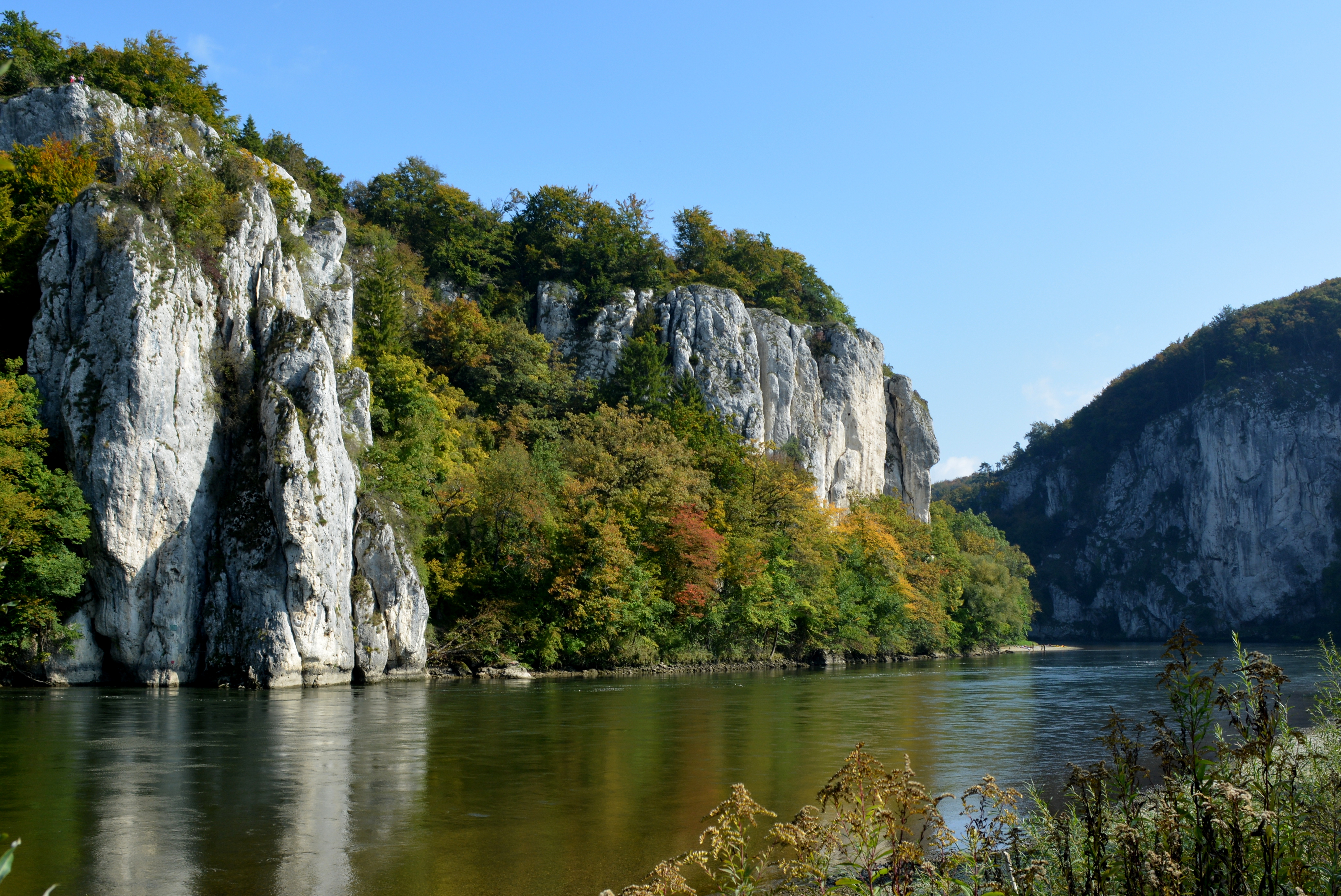
Deutsch: Das ursprüngliche Tal der Donau (Ur-Donau oberhalb Kelheim) war fünf Millionen Jahre lang das heutige Altmühltal, das mit dem heutigen Donauverlauf über das Wellheimer Trockental verbunden ist. Bei Kelheim mündete damals ein aus Richtung Ingolstadt kommender Nebenfluss ("Ingolstädter Albsaumfluss"). Dieser hatte sich durch ständige Eintiefung des Flusses in Richtung Quelle ("rückschreitende Erosion") langsam durch den harten Riegel der Malmkalke gegraben, und so die Schlucht der Weltenburger Enge geschaffen.
Bereits 1840 erhob sie König Ludwig I. zum ersten Naturschutzgebiet Bayerns. Quelle: Bayerisches Landesamt für Umwelt |
| Date | |
| Source | Own work |
| Author | Apollo481 |
Geotop-Nr. 273R005 Nähe Kloster Weltenburg
Licensing
edit
I, the copyright holder of this work, hereby publish it under the following license:
This file is licensed under the Creative Commons Attribution-Share Alike 3.0 Unported license.
- You are free:
- to share – to copy, distribute and transmit the work
- to remix – to adapt the work
- Under the following conditions:
- attribution – You must give appropriate credit, provide a link to the license, and indicate if changes were made. You may do so in any reasonable manner, but not in any way that suggests the licensor endorses you or your use.
- share alike – If you remix, transform, or build upon the material, you must distribute your contributions under the same or compatible license as the original.
This image was uploaded as part of Wiki Loves Earth 2015.
|
 |
File history
Click on a date/time to view the file as it appeared at that time.
| Date/Time | Thumbnail | Dimensions | User | Comment | |
|---|---|---|---|---|---|
| current | 15:44, 16 May 2015 | | 4,332 × 2,896 (5.99 MB) | Apollo481 (talk | contribs) | User created page with UploadWizard |
You cannot overwrite this file.
File usage on Commons
The following 2 pages use this file:
File usage on other wikis
The following other wikis use this file:
- Usage on de.wikipedia.org
- Usage on ro.wikipedia.org
- Usage on www.wikidata.org