File:West Midlands districts 2011 map.svg

Size of this PNG preview of this SVG file: 533 × 600 pixels. Other resolutions: 213 × 240 pixels | 427 × 480 pixels | 683 × 768 pixels | 910 × 1,024 pixels | 1,821 × 2,048 pixels | 1,161 × 1,306 pixels.
Original file (SVG file, nominally 1,161 × 1,306 pixels, file size: 1.33 MB)
Captions
Captions
Add a one-line explanation of what this file represents
Summary
edit
| Description |
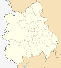
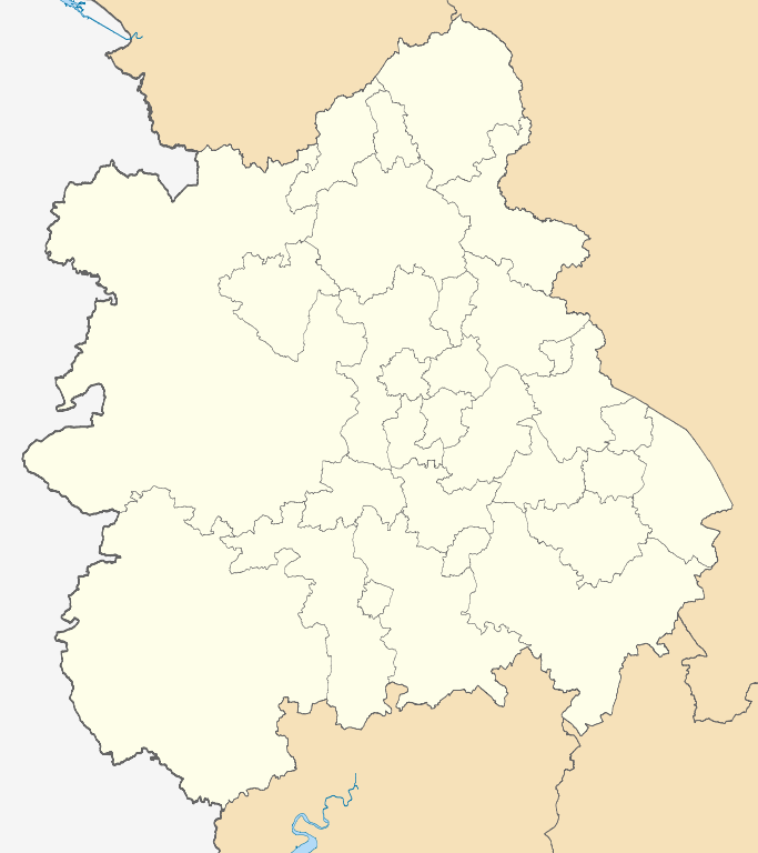
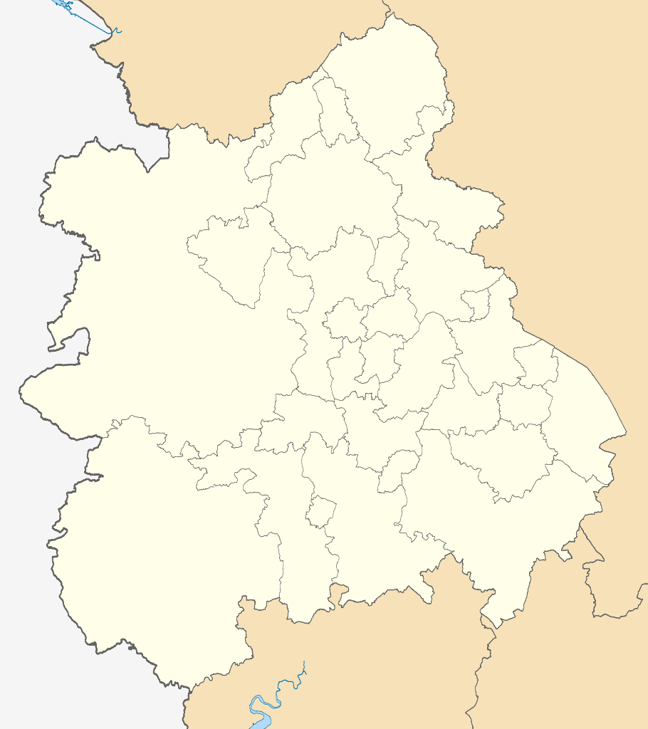
Map of the West Midlands region showing the administrative districts. Equirectangular map projection on WGS 84 datum, with N/S stretched 165% Geographic limits:
|
| Date | |
| Source |
|
| Author | Nilfanion, created using Ordnance Survey data |
| Other versions |
Derivative works of this file: |
Licensing
edit
I, the copyright holder of this work, hereby publish it under the following licenses:
This file is licensed under the Creative Commons Attribution-Share Alike 3.0 Unported license.
- You are free:
- to share – to copy, distribute and transmit the work
- to remix – to adapt the work
- Under the following conditions:
- attribution – You must give appropriate credit, provide a link to the license, and indicate if changes were made. You may do so in any reasonable manner, but not in any way that suggests the licensor endorses you or your use.
- share alike – If you remix, transform, or build upon the material, you must distribute your contributions under the same or compatible license as the original.

|
Permission is granted to copy, distribute and/or modify this document under the terms of the GNU Free Documentation License, Version 1.2 or any later version published by the Free Software Foundation; with no Invariant Sections, no Front-Cover Texts, and no Back-Cover Texts. A copy of the license is included in the section entitled GNU Free Documentation License. |
You may select the license of your choice.
File history
Click on a date/time to view the file as it appeared at that time.
| Date/Time | Thumbnail | Dimensions | User | Comment | |
|---|---|---|---|---|---|
| current | 19:06, 1 May 2011 | | 1,161 × 1,306 (1.33 MB) | Nilfanion (talk | contribs) | == Summary == {{Information |Description=Map of the West Midlands region showing the administrative districts. Equirectangular map projection on WGS 84 datum, with N/S stretched 165% Geographic limits: *West: 3.3W *East: 1.1W *North: |
You cannot overwrite this file.
File usage on Commons
The following 4 pages use this file:
File usage on other wikis
The following other wikis use this file:
- Usage on en.wikipedia.org
- Worcestershire
- Coventry
- Shropshire
- West Midlands (county)
- Staffordshire
- Tamworth, Staffordshire
- Stoke-on-Trent
- Midlands
- Newcastle-under-Lyme
- Telford and Wrekin
- Sandwell
- Nuneaton and Bedworth
- West Midlands (region)
- Borough of Rugby
- Redditch
- Warwickshire
- Herefordshire
- Metropolitan Borough of Dudley
- North Warwickshire
- East Staffordshire
- Stratford-on-Avon District
- Warwick District
- Borough of Stafford
- South Staffordshire
- Staffordshire Moorlands
- Malvern Hills District
- Wychavon
- Template:West Midlands
- Metropolitan Borough of Walsall
- Borough of Newcastle-under-Lyme
- Cannock Chase District
- Lichfield District
- Bromsgrove District
- Metropolitan Borough of Solihull
- Broadwell, Warwickshire
- Kites Hardwick
- Bignall End
- Wyre Forest District
- Singers Hill Synagogue
- User:Phildav76/Regional templates
- Cound
- Shelton, Staffordshire
- Wolverhampton
- Birmingham
- Wikipedia:WikiProject Countries/Templates/Navboxes/European country subdivisions
- Birmingham Central Synagogue
- West Midlands Regional Women's Football League
- 2014–15 Midland Football League
- List of boundary changes in the West Midlands (region)
- Wikipedia:WikiProject Navigation templates/Country subdivisions/United Kingdom/England
View more global usage of this file.