File:West Yorkshire outline map with UK.png
No higher resolution available.
West_Yorkshire_outline_map_with_UK.png (800 × 558 pixels, file size: 407 KB, MIME type: image/png)
Captions
Captions
Add a one-line explanation of what this file represents
Summary
edit
| Description |
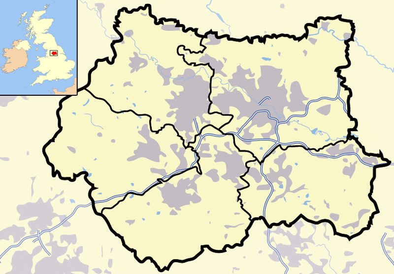
Map of en:West Yorkshire and surrounding area, with indented map of the British Isles for national context. County and borough boundaries in black, urban areas in grey, motorways in blue with white stripe, water bodies in light blue. |
| Date | 9 April 2007 (original upload date) |
| Source | Transferred from en.wikipedia to Commons. |
| Author | Jhamez84 at English Wikipedia |
Licensing
edit
| This work has been released into the public domain by its author, Jhamez84 at English Wikipedia. This applies worldwide. In some countries this may not be legally possible; if so: Jhamez84 grants anyone the right to use this work for any purpose, without any conditions, unless such conditions are required by law. |
Original upload log
edit
The original description page was here. All following user names refer to en.wikipedia.
- 2007-04-09 23:11 Jhamez84 800×558×8 (416924 bytes) Map of [[West Yorkshire]] and surrounding area, with indented map of the British Isles for national context. County and borough boundaries in black, urban areas in grey, motorways in blue with white stripe, water bodies in light blue.
File history
Click on a date/time to view the file as it appeared at that time.
| Date/Time | Thumbnail | Dimensions | User | Comment | |
|---|---|---|---|---|---|
| current | 21:02, 29 June 2007 | | 800 × 558 (407 KB) | Pit-yacker (talk | contribs) | {{Information |Description=Map of en:West Yorkshire and surrounding area, with indented map of the British Isles for national context. County and borough boundaries in black, urban areas in grey, motorways in blue with white stripe, water bodies in |
You cannot overwrite this file.
File usage on Commons
There are no pages that use this file.
File usage on other wikis
The following other wikis use this file:
- Usage on cs.wikipedia.org
- Usage on en.wikipedia.org
- Usage on en.wikinews.org
- Usage on es.wikipedia.org
- Usage on id.wikipedia.org
- Chapel Allerton
- Farnley
- Headingley
- Roundhay
- Seacroft
- Shadwell
- Pudsey
- Otley
- Garforth
- Templat:Location map West Yorkshire
- Rothwell
- Wetherby
- Holbeck
- Hunslet
- Armley
- Wortley
- Burley, Leeds
- Cross Gates
- Middleton
- Gipton
- Belle Isle
- Halton Moor
- Moortown
- Alwoodley
- Colton, Leeds
- Oakwood, Leeds
- Adel, Leeds
- Bramley, Leeds
- Katedral Leeds
- Usage on it.wikipedia.org
- Usage on ml.wikipedia.org
- Usage on qu.wikipedia.org
- Usage on ug.wikipedia.org