File:WestcoastSeaplates.svg

Original file (SVG file, nominally 878 × 666 pixels, file size: 106 KB)
Captions
Captions
| Description |
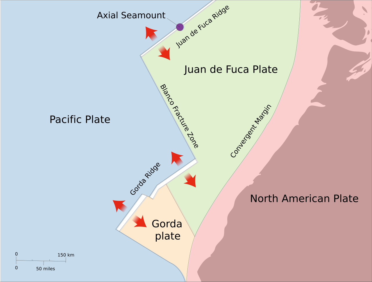
Map of Juan de Fuca Ridge - Gorda Ridge - Axial Seamount - Blanco facture zone -- showing features of Pacific/Juan de Fuca/North American subduction system relative to Western United States. Open blue arrows, ridge-spreading directions; solid blue arrow, convergence direction. -- Modified from: Swanson, et al., (1989) IGC Field Trip T106: Cenozoic Volcanism in the Cascade Range and Columbia Plateau, Southern Washington and Northernmost Oregon, p.2 Redrawn as SVG with enhancements. |
| Date | (UTC) |
| Source | |
| Author |
|
This image is in the public domain in the United States because it only contains materials that originally came from the United States Geological Survey, an agency of the United States Department of the Interior. For more information, see the official USGS copyright policy.
|
Original upload log
edit
This image is a derivative work of the following images:
- File:Juan_de_fuca_ridge-south-map-usgs.png licensed with PD-USGov-USGS
- 2007-01-18T22:21:56Z Bejnar 424x520 (12558 Bytes) {{Information |Description=Map of Juan de Fuca Ridge - Gorda Ridge - Axial Seamount - Blanco facture zone -- showing features of Pacific/Juan de Fuca/North American subduction system relative to Western United States. Open bl
Uploaded with derivativeFX
File history
Click on a date/time to view the file as it appeared at that time.
| Date/Time | Thumbnail | Dimensions | User | Comment | |
|---|---|---|---|---|---|
| current | 02:59, 28 December 2010 | | 878 × 666 (106 KB) | Jkwchui (talk | contribs) | fixed fonts again |
| 02:51, 28 December 2010 |  | 878 × 666 (106 KB) | Jkwchui (talk | contribs) | fixed fonts | |
| 02:49, 28 December 2010 |  | 35 × 27 (104 KB) | Jkwchui (talk | contribs) | fixed canvas | |
| 02:48, 28 December 2010 |  | 389 × 377 (104 KB) | Jkwchui (talk | contribs) | {{Information |Description=Map of Juan de Fuca Ridge - Gorda Ridge - Axial Seamount - Blanco facture zone -- showing features of Pacific/Juan de Fuca/North American subduction system relative to Western United States. Open blue arrows, ridge-spreading dir |
You cannot overwrite this file.
File usage on Commons
The following page uses this file:
File usage on other wikis
The following other wikis use this file:
- Usage on az.wikipedia.org
- Usage on de.wikipedia.org
- Usage on en.wikipedia.org
- Usage on es.wikipedia.org
- Usage on fr.wikipedia.org
- Usage on it.wikipedia.org
- Usage on pl.wikipedia.org