File:Western Pahari.jpg
No higher resolution available.
Western_Pahari.jpg (100 × 110 pixels, file size: 5 KB, MIME type: image/jpeg)
Captions
Captions
Add a one-line explanation of what this file represents

|
This file was moved to Wikimedia Commons from en.wikipedia using a bot script. All source information is still present. It requires review. Additionally, there may be errors in any or all of the information fields; information on this file should not be considered reliable and the file should not be used until it has been reviewed and any needed corrections have been made. Once the review has been completed, this template should be removed. For details about this file, see below. Check now! |

|
This file has been superseded by Dogri-Kangri region.png. It is recommended to use the other file. Please note that deleting superseded images requires consent. Reason to use the other file: "A PNG version of this file is now available."
|

|
Summary
edit
| Description |
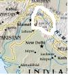
English: I made this map based on a section of the CIA World Factbook's map of Asia. |
| Date | 6 February 2006 (original upload date) |
| Source |
Own work Transferred from en.wikipedia |
| Author | AllPeopleUnite at en.wikipedia |
Licensing
edit
| |
This work has been released into the public domain by its author, AllPeopleUnite, at the English Wikipedia project. This applies worldwide. In case this is not legally possible: |
Original upload log
edit
The original description page was here. All following user names refer to en.wikipedia.
- 2006-02-06 21:08 AllPeopleUnite 100×110 (4785 bytes) I made this map based on a section of the CIA World Factbook's map of Asia.
File history
Click on a date/time to view the file as it appeared at that time.
| Date/Time | Thumbnail | Dimensions | User | Comment | |
|---|---|---|---|---|---|
| current | 19:17, 7 November 2011 | | 100 × 110 (5 KB) | MGA73bot2 (talk | contribs) | {{BotMoveToCommons|en.wikipedia|year={{subst:CURRENTYEAR}}|month={{subst:CURRENTMONTHNAME}}|day={{subst:CURRENTDAY}}}} == {{int:filedesc}} == {{Information |description={{en|1=I made this map based on a section of the CIA World Factbook's map of Asia.}} |
You cannot overwrite this file.
File usage on Commons
The following page uses this file: