File:Wfm red rock island.jpg

Size of this preview: 444 × 599 pixels. Other resolutions: 178 × 240 pixels | 355 × 480 pixels | 948 × 1,280 pixels.
Original file (948 × 1,280 pixels, file size: 184 KB, MIME type: image/jpeg)
Captions
Captions
Add a one-line explanation of what this file represents
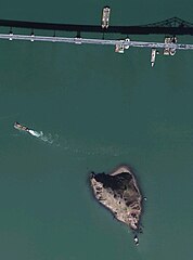
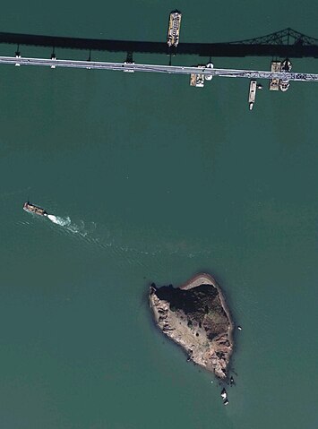
Red Rock Island and a section of the Richmond-San Rafael Bridge in San Francisco Bay, Northern California, USA.
USGS aerial photograph ("urban area ortho"). Final image made using NASA World Wind.
| This image is in the public domain because it is a screenshot from NASA’s globe software World Wind using a public domain layer, such as Blue Marble, MODIS, Landsat, SRTM, USGS or GLOBE.
|
 |
File history
Click on a date/time to view the file as it appeared at that time.
| Date/Time | Thumbnail | Dimensions | User | Comment | |
|---|---|---|---|---|---|
| current | 14:17, 21 October 2006 | | 948 × 1,280 (184 KB) | Finlay McWalter (talk | contribs) | Red Rock Island and a section of the Richmond-San Rafael Bridge in San Francisco Bay, Northern California, USA. NASA Landsat 7 image. Final image made using NASA World Wind. {{PD-WorldWind}} category:California |
You cannot overwrite this file.
File usage on Commons
There are no pages that use this file.
File usage on other wikis
The following other wikis use this file:
- Usage on ar.wikipedia.org
- Usage on en.wikipedia.org
- Usage on fa.wikipedia.org