File:Wierzbinek (gmina) location map.png
Size of this preview: 800 × 504 pixels. Other resolutions: 320 × 202 pixels | 640 × 403 pixels | 960 × 605 pixels.
Original file (960 × 605 pixels, file size: 114 KB, MIME type: image/png)
Captions
Captions
Add a one-line explanation of what this file represents
| Description |
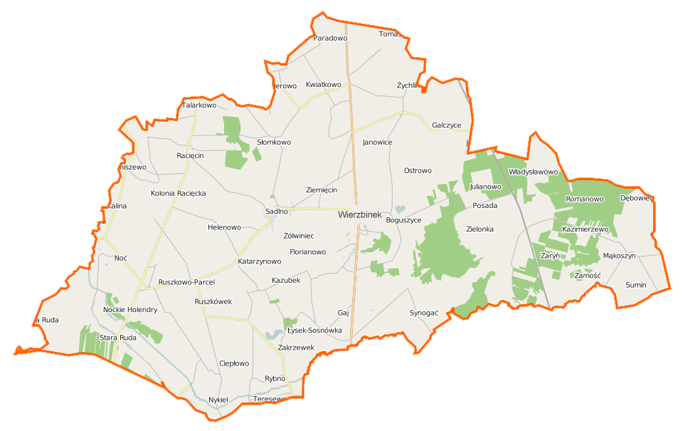
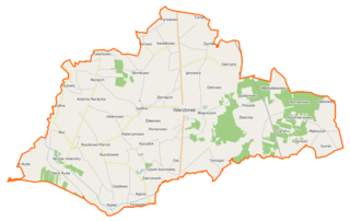
Polski: Mapa gminy Wierzbinek, Polska
English: Map of Gmina Wierzbinek, Poland |
|||||||||
| Date | ||||||||||
| Source | You may find a page on the OpenStreetMap wiki page for Wierzbinek (gmina) | |||||||||
| Creator |
OpenStreetMap contributors OpenStreetMap contributors |
|||||||||
| Permission (Reusing this file) |
OpenStreetMap data is available under the Open Database License (details). Map tiles are licensed under the Creative Commons Attribution-ShareAlike 2.0 license (CC-BY-SA 2.0).
This file is licensed under the Creative Commons Attribution-Share Alike 2.0 Generic license.
|
|||||||||
| Geotemporal data | ||||||||||
| Bounding box |
|
|||||||||
| Georeferencing | If inappropriate please set warp_status = skip to hide. | |||||||||
File history
Click on a date/time to view the file as it appeared at that time.
| Date/Time | Thumbnail | Dimensions | User | Comment | |
|---|---|---|---|---|---|
| current | 18:29, 11 December 2014 | | 960 × 605 (114 KB) | VanWiel (talk | contribs) | {{OpenStreetMap | name = Wierzbinek (gmina) | location = Wierzbinek (gmina) | description = {{pl|Mapa gminy Wierzbinek, Polska}} {{en|Map of Gmina Wierzbinek, Poland}} | top = 52.5083 | bottom = 52.... |
You cannot overwrite this file.
File usage on Commons
There are no pages that use this file.
File usage on other wikis
The following other wikis use this file:
- Usage on de.wikipedia.org
- Usage on fr.wikipedia.org
- Wierzbinek (gmina)
- Wierzbinek
- Boguszyce (Grande-Pologne)
- Boguszyczki
- Broniszewo (Konin)
- Cegielnia-Rudki
- Chlebowo (Konin)
- Chrząszczewo (Grande-Pologne)
- Ciepłowo
- Dębowiec (Konin)
- Dobra Wola (Grande-Pologne)
- Florianowo (Grande-Pologne)
- Gaj (Konin)
- Helenowo (Wierzbinek)
- Janinów (Grande-Pologne)
- Dziadoch
- Galczyce
- Galczyczki
- Goczki Polskie
- Janowice (Wierzbinek)
- Julianowo (Grande-Pologne)
- Kalina (Konin)
- Janowo Racięckie
- Katarzynowo (Konin)
- Kazimierowo (Grande-Pologne)
- Kazimierzewo (Grande-Pologne)
- Kazubek (Wierzbinek)
- Kolonia Racięcka
- Kryszkowice
- Krzymowo
- Kwiatkowo (Grande-Pologne)
- Leszczyc (Grande-Pologne)
- Łysek (Grande-Pologne)
- Łysek-Sosnówka
- Majdany (Konin)
- Mąkoszyn (Grande-Pologne)
- Mielno (Konin)
- Morzyczyn (Grande-Pologne)
- Noć
- Nockie Holendry
- Nowa Ruda (Grande-Pologne)
- Nowiny Kryszkowskie
- Nykiel
- Obory (Konin)
- Ostrówek (Wierzbinek)
- Ostrowo (Konin)
- Pagórki (Grande-Pologne)
- Palmowo
- Pamiątka (Grande-Pologne)
View more global usage of this file.
_location_map.png)
_location_map.png&oldid=506017494)