File:Wildfires in Pantanal Matogrossense National Park, Brazil.jpg

Original file (3,508 × 2,540 pixels, file size: 1.86 MB, MIME type: image/jpeg)
Captions
Captions
Summary
edit
| Description |
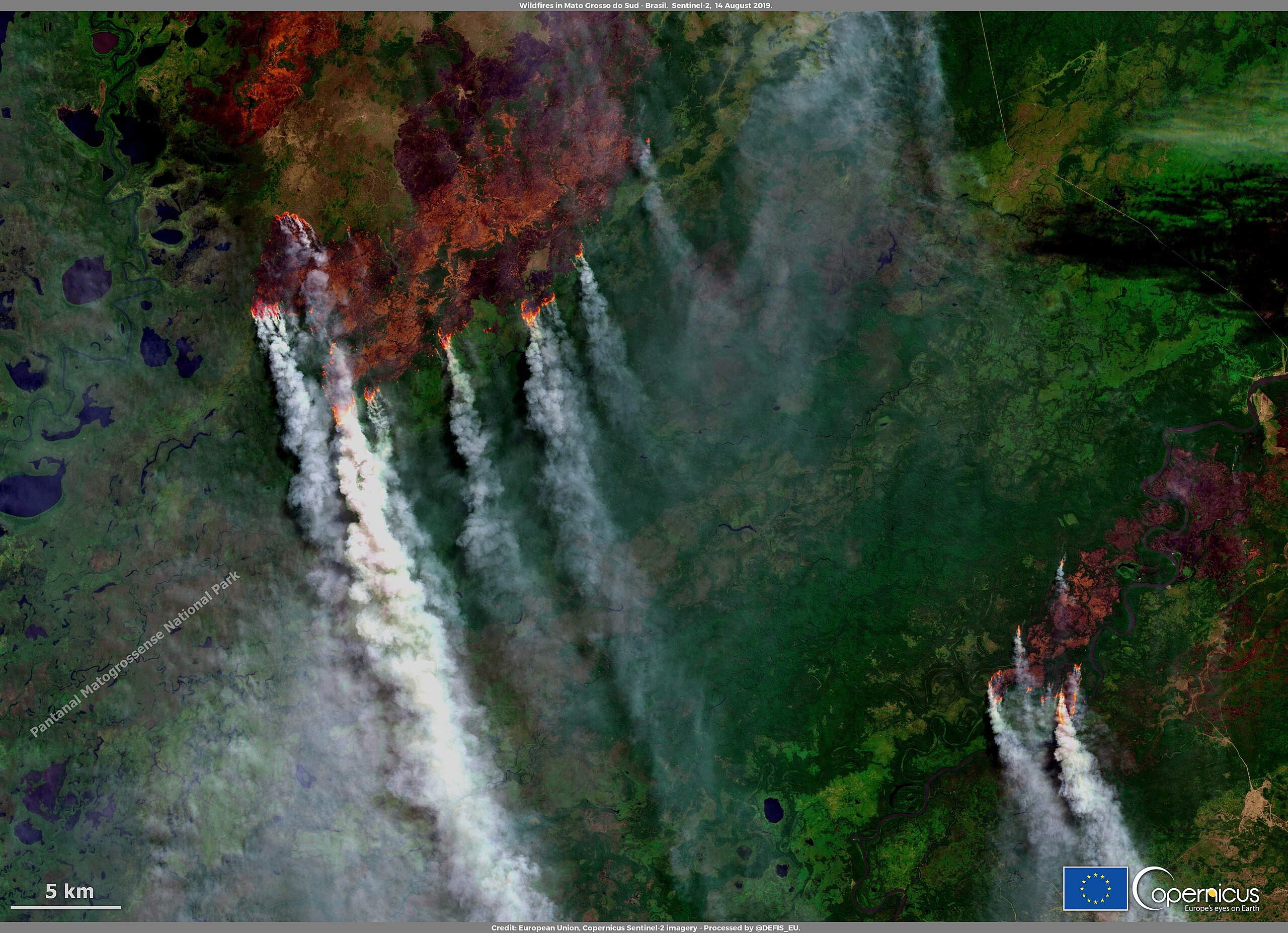
English: The Pantanal, in Brazil, is a UNESCO World Heritage Site renowned for its unique biodiversity. During the first half of 2020 severe drought conditions affected South America, and in particular the Pantanal area. One of the immediate consequences has been an increase in the number of wildfires: as reported by Instituto Nacional de Pesquisas Espaciais (INPE – Brazil’s Space Research Centre), the overall number of fires increased by 233% in the Pantanal area compared to the previous year. This image, acquired by one of the Copernicus Sentinel-2 satellites on 14 August, shows ongoing wildfires in the Pantanal Matogrossense National Park (Mato Grosso state). With a revisit time of five days on average at the equator, the Copernicus Sentinel-2 satellites deliver free and open data that can be used to monitor wildfires and their impact on land and vegetation |
| Date | 17 August 2020 (upload date) |
| Source | Wildfires in Pantanal Matogrossense National Park, Brazil |
| Author | European Union , Copernicus Sentinel-2 imagery |
Licensing
edit

|
This image contains data from a satellite in the Copernicus Programme, such as Sentinel-1, Sentinel-2 or Sentinel-3. Attribution is required when using this image.
Attribution: Contains modified Copernicus Sentinel data 2020
The use of Copernicus Sentinel Data is regulated under EU law (Commission Delegated Regulation (EU) No 1159/2013 and Regulation (EU) No 377/2014). Relevant excerpts:
Free access shall be given to GMES dedicated data [...] made available through GMES dissemination platforms [...].
Access to GMES dedicated data [...] shall be given for the purpose of the following use in so far as it is lawful:
GMES dedicated data [...] may be used worldwide without limitations in time.
GMES dedicated data and GMES service information are provided to users without any express or implied warranty, including as regards quality and suitability for any purpose. |
File history
Click on a date/time to view the file as it appeared at that time.
| Date/Time | Thumbnail | Dimensions | User | Comment | |
|---|---|---|---|---|---|
| current | 09:45, 31 July 2023 | | 3,508 × 2,540 (1.86 MB) | OptimusPrimeBot (talk | contribs) | #Spacemedia - Upload of https://www.copernicus.eu/system/files/2020-08/image_day/Wildfires_MatoGrosso_Brasil_credit_row3.jpg via Commons:Spacemedia |
You cannot overwrite this file.
File usage on Commons
There are no pages that use this file.