File:Wildfires in Yukon Territory (MODIS 2019-09-15).jpg

Size of this preview: 774 × 599 pixels. Other resolutions: 310 × 240 pixels | 620 × 480 pixels | 992 × 768 pixels | 1,280 × 991 pixels | 1,909 × 1,478 pixels.
Original file (1,909 × 1,478 pixels, file size: 210 KB, MIME type: image/jpeg)
Captions
Captions
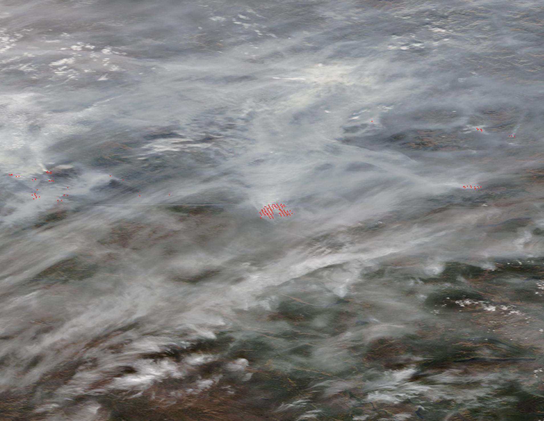
The Moderate Resolution Imaging Spectroradiometer acquired a true-color image of gray smoke over Yukon Territory on September 11.
Summary
edit.jpg&action=edit§ion=1)
| Description |
English: Warm and windy conditions continued to stoke multiple fires burning in Canada’s Yukon Territory, resulting in heavy smoke blanketing the region in mid-September 2019. The Moderate Resolution Imaging Spectroradiometer acquired a true-color image of gray smoke over Yukon Territory on September 11. Mixing with a few white clouds, the smoke creates a blanket so thick that it shrouds the land beneath from view.
Red “hot spots” mark areas where the thermal bands on the instrument detected high temperatures. When combined with typical smoke, as in this image, such hotspots mark actively burning fire. In the center of the image a large fire shows up as a number of hot spots neatly arranged in rows. In fact, that area represents one large fire with very heavy smoke. As of September 12, the Canadian news company, CBC, reported that there were 52 active wildfires in Yukon. The area with the most activity was the Mayo region of central Yukon, with 20 active fires. The North Crooked Creek fire was particularly aggressive, reaching 17,702 hectares in size on September 11. Wildland Fire Management crews evacuated 18 residents from Ethel Lake ahead of the blaze. An Evacuation Alert was issued by Yukon Emergency Measures Organization for an area with a radius of 5 kilometers (3 miles) around Stewart Crossing and extending 12 kilometers (7.5 miles) south-east to Ethel Lake road. |
||
| Date | Taken on 11 September 2019 | ||
| Source |
Wildfires in Yukon Territory (direct link)
|
||
| Author | MODIS Land Rapid Response Team, NASA GSFC |
| This media is a product of the Terra mission Credit and attribution belongs to the mission team, if not already specified in the "author" row |
Licensing
edit.jpg&action=edit§ion=2)
| This file is in the public domain in the United States because it was solely created by NASA. NASA copyright policy states that "NASA material is not protected by copyright unless noted". (See Template:PD-USGov, NASA copyright policy page or JPL Image Use Policy.) | ||
 |
Warnings:
|
File history
Click on a date/time to view the file as it appeared at that time.
| Date/Time | Thumbnail | Dimensions | User | Comment | |
|---|---|---|---|---|---|
| current | 03:03, 17 February 2024 | | 1,909 × 1,478 (210 KB) | OptimusPrimeBot (talk | contribs) | #Spacemedia - Upload of http://modis.gsfc.nasa.gov/gallery/images/image09152019_250m.jpg via Commons:Spacemedia |
You cannot overwrite this file.
File usage on Commons
There are no pages that use this file.
.jpg&oldid=852772847)