File:Wilmington North Carolina port aerial view.jpg
Size of this preview: 800 × 534 pixels. Other resolutions: 320 × 214 pixels | 640 × 427 pixels | 1,024 × 683 pixels | 1,500 × 1,001 pixels.
Original file (1,500 × 1,001 pixels, file size: 589 KB, MIME type: image/jpeg)
Captions
Captions
Add a one-line explanation of what this file represents
| Description |
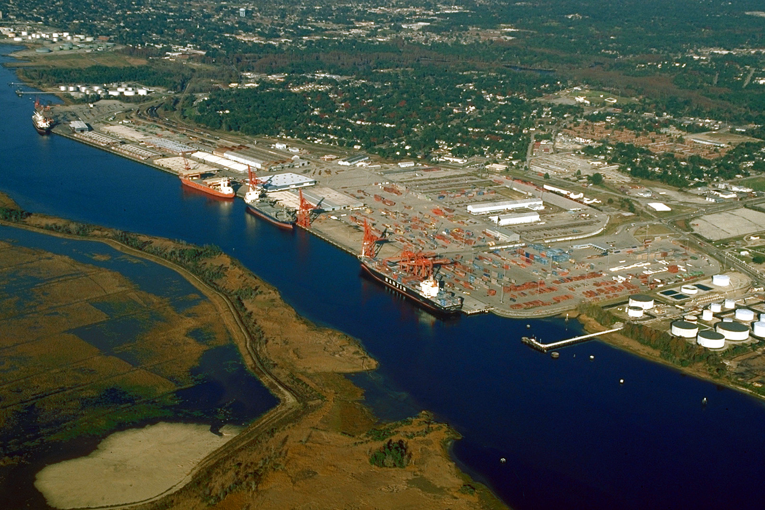
English: Aerial view of the port and city of Wilmington, North Carolina, USA. The port facility is located on the estuary of the Cape Fear River. View is upriver to the north. In this photograph the tide is apparently flowing in quite strongly.
Coordinates: 34°11′48.31″N 77°57′17.51″W / 34.1967528°N 77.9548639°W |
|||
| Location | Wilmington, North Carolina, USA | |||
| Date | (Caveat: Dates provided by U.S. Army Corps of Engineers Digital Visual Library are not reliable and are often wrong.) | |||
| Source |
U.S. Army Corps of Engineers Digital Visual Library Image page Image description page Digital Visual Library home page |
|||
| Author | Bud Davis, U.S. Army Corps of Engineers | |||
| Permission (Reusing this file) |
|
File history
Click on a date/time to view the file as it appeared at that time.
| Date/Time | Thumbnail | Dimensions | User | Comment | |
|---|---|---|---|---|---|
| current | 04:05, 26 April 2007 | | 1,500 × 1,001 (589 KB) | DanMS (talk | contribs) | {{Information | Description = {{en|Aerial view of the port and city of Wilmington, North Carolina, USA. The port facility is located on the estuary of the Cape Fear River. View is upriver to the north. In this photograph the tide is apparently flowing |
You cannot overwrite this file.
File usage on Commons
The following page uses this file:
File usage on other wikis
The following other wikis use this file:
- Usage on de.wikipedia.org
- Usage on en.wikipedia.org
- Usage on fr.wikipedia.org
- Usage on he.wikipedia.org
- Usage on it.wikipedia.org
- Usage on pl.wikipedia.org
- Usage on ru.wikipedia.org
- Usage on uk.wikipedia.org