File:WinkelnVenn1805(TrK42-Viersen).jpg
Size of this preview: 800 × 450 pixels. Other resolutions: 320 × 180 pixels | 640 × 360 pixels | 1,024 × 576 pixels.
Original file (1,024 × 576 pixels, file size: 851 KB, MIME type: image/jpeg)
Captions
Captions
Add a one-line explanation of what this file represents
Summary edit
.jpg&action=edit§ion=1)
| Description |
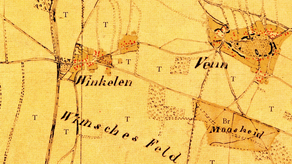
Deutsch: Kartenaufnahme der Rheinlande durch Tranchot und von Müffling, Blatt 42 (Viersen), Ausschnitt mit dem Gebiet der Dörfer Winkeln und Venn.
Nederlands: Topografische opname van't Rijnland door Tranchot en von Müffling, blad 42 (Viersen), uittreksel met het gebied van de dorpen Winkeln en Venn. |
| Date | circa 1805/06 (Erstellung), herausgegeben: vor 1820 |
| Source | selbst abgescannt: Vorlage war ein vom Landesvermessungsamt NRW (heute: Geobasisdaten Land NRW), Bonn 1966 herausgegebener Nachdruck |
| Author | Capitaine Ing.-Geograph 1.Klasse M. Maissiat |
Licensing edit
.jpg&action=edit§ion=2)
|
This work is in the public domain in its country of origin and other countries and areas where the copyright term is the author's life plus 70 years or fewer. This work is in the public domain in the United States because it was published (or registered with the U.S. Copyright Office) before January 1, 1929. | |
| This file has been identified as being free of known restrictions under copyright law, including all related and neighboring rights. | |
File history
Click on a date/time to view the file as it appeared at that time.
| Date/Time | Thumbnail | Dimensions | User | Comment | |
|---|---|---|---|---|---|
| current | 21:45, 18 May 2012 | | 1,024 × 576 (851 KB) | Þomas (talk | contribs) | == {{int:filedesc}} == {{Information |Description ={{de|1=Kartenaufnahme der Rheinlande durch Tranchot und von Müffling, Blatt 42 (Viersen), Ausschnitt mit dem Gebiet der Dörfer ''Winkeln'' und ''Venn''.}} {{nl|1=Topografische opname van't Rijnlan... |
You cannot overwrite this file.
File usage on Commons
There are no pages that use this file.
File usage on other wikis
The following other wikis use this file:
- Usage on de.wikipedia.org
.jpg&oldid=209004165)