File:Winnipeg.jpg

Size of this preview: 649 × 600 pixels. Other resolutions: 260 × 240 pixels | 519 × 480 pixels | 831 × 768 pixels | 1,108 × 1,024 pixels | 1,424 × 1,316 pixels.
Original file (1,424 × 1,316 pixels, file size: 2.02 MB, MIME type: image/jpeg)
Captions
Captions
Add a one-line explanation of what this file represents
Summary
edit
| Description | |
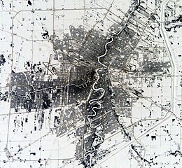
| Source | Satellite image |
| Author | NASA |
Licensing
edit
| This file is in the public domain in the United States because it was solely created by NASA. NASA copyright policy states that "NASA material is not protected by copyright unless noted". (See Template:PD-USGov, NASA copyright policy page or JPL Image Use Policy.) | ||
 |
Warnings:
|
Original upload log
edit
The original description page was here. All following user names refer to en.wikipedia.
File history
Click on a date/time to view the file as it appeared at that time.
| Date/Time | Thumbnail | Dimensions | User | Comment | |
|---|---|---|---|---|---|
| current | 22:56, 1 March 2009 | | 1,424 × 1,316 (2.02 MB) | File Upload Bot (Magnus Manske) (talk | contribs) | {{BotMoveToCommons|en.wikipedia|year={{subst:CURRENTYEAR}}|month={{subst:CURRENTMONTHNAME}}|day={{subst:CURRENTDAY}}}} {{Information |Description={{en|Source:[http://eol.jsc.nasa.gov/scripts/sseop/QuickView.pl?directory=ESC&ID=ISS006-E-29346 http://eol.j |
You cannot overwrite this file.
File usage on Commons
There are no pages that use this file.
File usage on other wikis
The following other wikis use this file:
- Usage on ar.wikipedia.org
- Usage on ceb.wikipedia.org
- Usage on en.wikipedia.org
- Charleswood, Winnipeg
- Royal Manitoba Theatre Centre
- Tuxedo, Winnipeg
- Old Kildonan
- St. Vital, Winnipeg
- West Kildonan, Winnipeg
- Fort Garry, Winnipeg
- North Kildonan
- Downtown Winnipeg
- St. Norbert, Winnipeg
- Weston, Winnipeg
- Jewish Heritage Centre (Winnipeg)
- Winnipeg Railway Museum
- Transport in Winnipeg
- List of airports in the Winnipeg area
- Wildwood Park, Winnipeg
- Waverley West
- Roblin Park
- Marlton, Winnipeg
- Garden City, Winnipeg
- Whyte Ridge, Winnipeg
- Island Lakes, Winnipeg
- Glenwood, Winnipeg
- Waverley Heights, Winnipeg
- Module:Location map/data/Canada Winnipeg/doc
- St. James Civic Centre
- St. Ignatius Church (Winnipeg)
- True North Square
- Richmond West, Winnipeg
- Module:Location map/data/Canada Winnipeg
- Vialoux, Winnipeg
- Ridgedale, Winnipeg
- Old Tuxedo, Winnipeg
- South Tuxedo, Winnipeg
- Usage on fa.wikipedia.org
- Usage on kn.wikipedia.org
- Usage on simple.wikipedia.org
- Usage on si.wikipedia.org
- Usage on tr.wikipedia.org
- Usage on uz.wikipedia.org
- Usage on war.wikipedia.org