File:WorldMap-A non-Frame-498x498-animated36steps.gif
No higher resolution available.
WorldMap-A_non-Frame-498x498-animated36steps.gif (251 × 251 pixels, file size: 863 KB, MIME type: image/gif, looped, 36 frames, 11 s)
Captions
Captions
Add a one-line explanation of what this file represents
Summary
edit
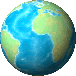
| Description | Topographic Map of the World non Frame Map created from DEMIS Mapserver, which are public domain. This map-server provided image max 2,000x2,000px, then 8 images was collected in one. Koba-chan See also World map in Japanese, Blank World map (7,966x3,982) |
| Date | (UTC) |
| Source | |
| Author |
|
| This is a retouched picture, which means that it has been digitally altered from its original version. Modifications: mapped to a spinning globe. The original can be viewed here: WorldMap-A non-Frame.png:
|
Licensing
edit
I, the copyright holder of this work, hereby publish it under the following license:

|
Permission is granted to copy, distribute and/or modify this document under the terms of the GNU Free Documentation License, Version 1.2 or any later version published by the Free Software Foundation; with no Invariant Sections, no Front-Cover Texts, and no Back-Cover Texts. A copy of the license is included in the section entitled GNU Free Documentation License. |
| This file is licensed under the Creative Commons Attribution-Share Alike 3.0 Unported license. | ||
| ||
| This licensing tag was added to this file as part of the GFDL licensing update. |
Original upload log
edit
This image is a derivative work of the following images:
- File:WorldMap-A_non-Frame.png licensed with GFDL, GFDL/en
- 2005-04-23T16:25:31Z Koba-chan 7964x3980 (8181501 Bytes) Topographic Map of the World non Frame Map created from [http://www2.demis.nl/mapserver/mapper.asp DEMIS Mapserver], which are public domain. This map-server provided image max 2,000x2,000px, then 8 images was collected in o
Uploaded with derivativeFX
File history
Click on a date/time to view the file as it appeared at that time.
| Date/Time | Thumbnail | Dimensions | User | Comment | |
|---|---|---|---|---|---|
| current | 00:04, 8 January 2009 | | 251 × 251 (863 KB) | Alexander.stohr (talk | contribs) | {{Information |Description=Topographic Map of the World non Frame Map created from [http://www2.demis.nl/mapserver/mapper.asp DEMIS Mapserver], which are public domain. This map-server provided image max 2,000x2,000px, then 8 images was collected in one. |
You cannot overwrite this file.
File usage on Commons
There are no pages that use this file.
File usage on other wikis
The following other wikis use this file:
- Usage on en.wikipedia.org
- Usage on es.wikipedia.org
- Usage on ro.wikipedia.org