File:World Map Hammer.svg

Size of this PNG preview of this SVG file: 751 × 375 pixels. Other resolutions: 320 × 160 pixels | 640 × 320 pixels | 1,024 × 511 pixels | 1,280 × 639 pixels | 2,560 × 1,278 pixels.
Original file (SVG file, nominally 751 × 375 pixels, file size: 200 KB)
Captions
Captions
Add a one-line explanation of what this file represents
Summary edit
| Description |
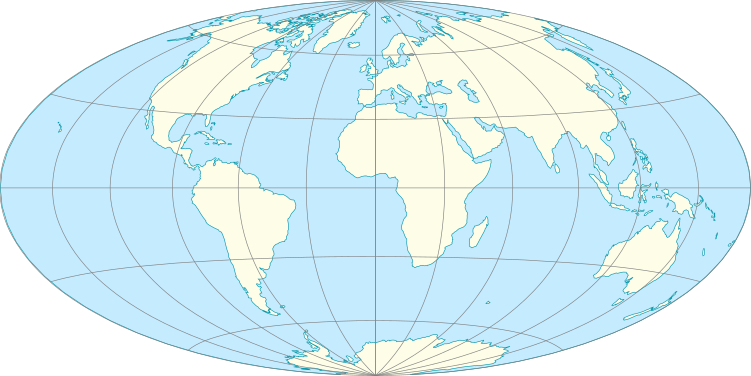
English: World Map using the Hammer projection, 30° grid. |
| Date | |
| Source | Own work using 1:110m Natural Earth Datasets |
| Author | Tentotwo |
Licensing edit
I, the copyright holder of this work, hereby publish it under the following license:
This file is licensed under the Creative Commons Attribution-Share Alike 3.0 Unported license.
- You are free:
- to share – to copy, distribute and transmit the work
- to remix – to adapt the work
- Under the following conditions:
- attribution – You must give appropriate credit, provide a link to the license, and indicate if changes were made. You may do so in any reasonable manner, but not in any way that suggests the licensor endorses you or your use.
- share alike – If you remix, transform, or build upon the material, you must distribute your contributions under the same or compatible license as the original.
Python script for generating the map using Mapnik edit
import mapnik2 as mapnik
import cairo
m = mapnik.Map(600,300,'+proj=hammer')

sland = mapnik.Style()
rland = mapnik.Rule()
rland.symbols.append(mapnik.PolygonSymbolizer(mapnik.Color('#fefee9')))
sland.rules.append(rland)
m.append_style('Land',sland)

socean = mapnik.Style()
rocean = mapnik.Rule()
rocean.symbols.append(mapnik.PolygonSymbolizer(mapnik.Color('#c6ecff')))
rocean.symbols.append(mapnik.LineSymbolizer(mapnik.Color('#0798ab'),0.5))
socean.rules.append(rocean)
m.append_style('Ocean',socean)

sgrat = mapnik.Style()
rgrat = mapnik.Rule()
rgrat.symbols.append(mapnik.LineSymbolizer(mapnik.Color('gray'),0.5))
sgrat.rules.append(rgrat)
m.append_style('Grat',sgrat)

lland = mapnik.Layer('land')
lland.datasource = mapnik.Shapefile(file='110m_land.shp')
lland.styles.append('Land')
m.layers.append(lland)

locean = mapnik.Layer('ocean')
locean.datasource =  mapnik.Shapefile(file='110m_ocean.shp')
locean.styles.append('Ocean')
m.layers.append(locean)

lgrat = mapnik.Layer('grat')
lgrat.datasource =  mapnik.Shapefile(file='ne_110m_graticules_30.shp')
lgrat.styles.append('Grat')
m.layers.append(lgrat)

lbb = mapnik.Layer('bb')
lbb.datasource =  mapnik.Shapefile(file='110m_wgs84_bounding_box.shp')
lbb.styles.append('Grat')
m.layers.append(lbb)

m.zoom_all()

surface = cairo.SVGSurface('mapfile.svg', m.width, m.height)
mapnik.render(m, surface)
surface.finish()
File history
Click on a date/time to view the file as it appeared at that time.
| Date/Time | Thumbnail | Dimensions | User | Comment | |
|---|---|---|---|---|---|
| current | 11:02, 21 September 2012 | | 751 × 375 (200 KB) | Tentotwo (talk | contribs) | Corrected border and bounding box |
| 10:23, 21 September 2012 |  | 751 × 376 (194 KB) | Tentotwo (talk | contribs) | User created page with UploadWizard |
You cannot overwrite this file.
File usage on Commons
There are no pages that use this file.
File usage on other wikis
The following other wikis use this file:
- Usage on az.wikipedia.org
- Usage on de.wikipedia.org