File:X4.33 Grimsel- und Furkastraße.jpg
Size of this preview: 800 × 530 pixels. Other resolutions: 320 × 212 pixels | 640 × 424 pixels | 1,024 × 678 pixels | 1,280 × 848 pixels | 2,560 × 1,696 pixels | 5,589 × 3,703 pixels.
Original file (5,589 × 3,703 pixels, file size: 5.23 MB, MIME type: image/jpeg)
Captions
Captions
Add a one-line explanation of what this file represents
Summary
edit
| Description |
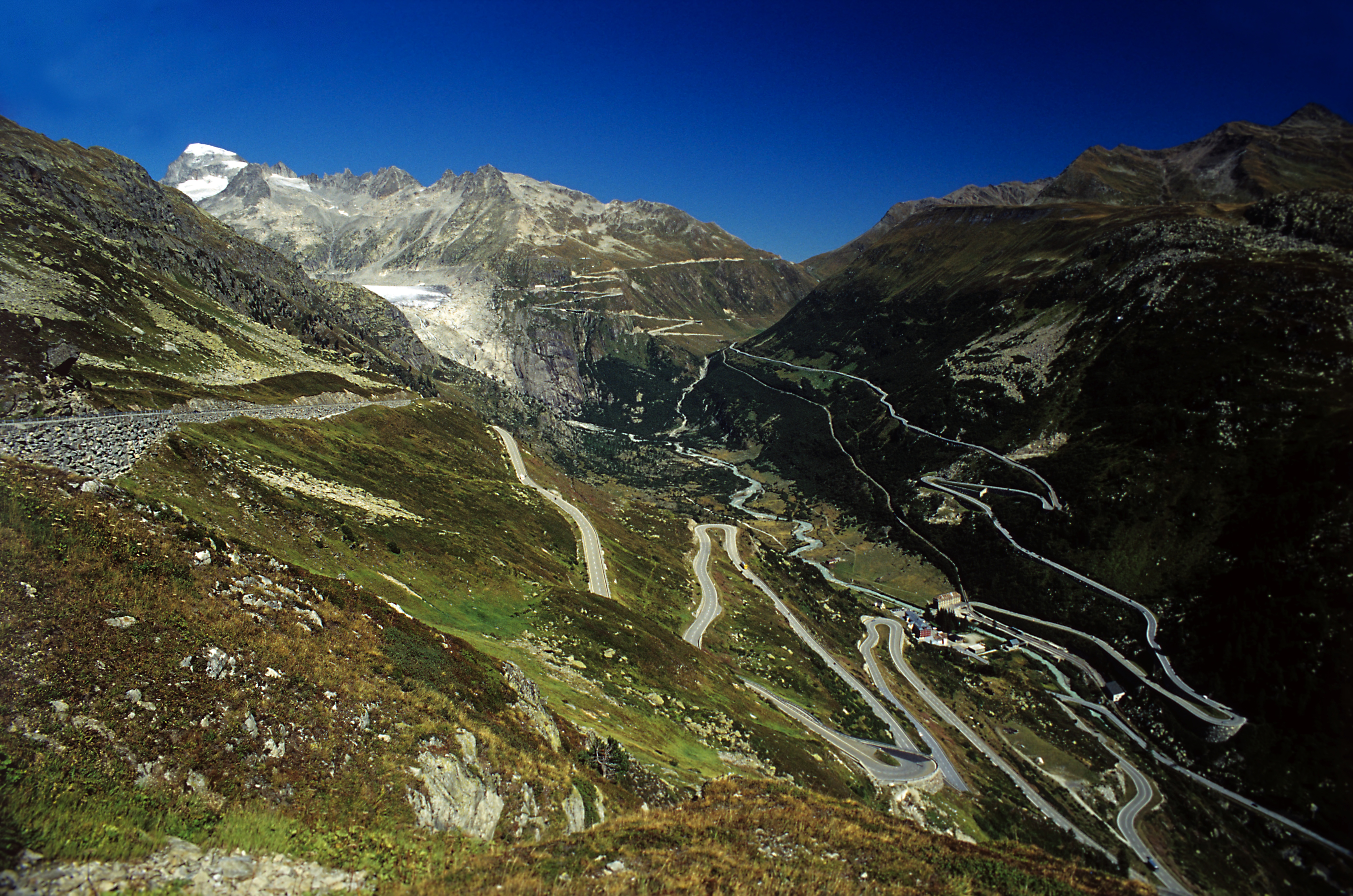
Deutsch: Vom Ostende des Totesees, die Grimselpassstraße fällt über sieben Serpentinenschläge von der Passhöhe zum Sommerdorf Gletsch von 2150 auf 1780 m ab. Im Hintergrund liegen die Furkapassstraße mit dem noch sichtbaren Rest des Rhônegletschers und die Furkabergstrecke, die durch den Zahnstangenbetrieb mit 90 ‰ Neigung deutlich direkter geführt werden konnte. |
| Date | |
| Source | Own work |
| Author | Falk2 |
Licensing
edit
This file is licensed under the Creative Commons Attribution-Share Alike 4.0 International license.
- You are free:
- to share – to copy, distribute and transmit the work
- to remix – to adapt the work
- Under the following conditions:
- attribution – You must give appropriate credit, provide a link to the license, and indicate if changes were made. You may do so in any reasonable manner, but not in any way that suggests the licensor endorses you or your use.
- share alike – If you remix, transform, or build upon the material, you must distribute your contributions under the same or compatible license as the original.
Original upload log
edit
Transferred from de.wikipedia to Commons by Wdwdbot using script bot_filetrans.pl (r122M).
The original description page was here. All following user names refer to de.wikipedia.
- 2022-02-25 07:33:22 Falk2 (5481219 Bytes)
File history
Click on a date/time to view the file as it appeared at that time.
| Date/Time | Thumbnail | Dimensions | User | Comment | |
|---|---|---|---|---|---|
| current | 10:42, 5 April 2022 | | 5,589 × 3,703 (5.23 MB) | Wdwdbot (talk | contribs) | Bot Move: Original uploader of this revision (#1) was Falk2 at de.wikipedia |
You cannot overwrite this file.
File usage on Commons
There are no pages that use this file.