File:Xiangyang Mountain Panorama.jpg

Size of this preview: 800 × 327 pixels. Other resolutions: 320 × 131 pixels | 640 × 261 pixels | 1,024 × 418 pixels | 1,280 × 522 pixels | 2,560 × 1,045 pixels | 6,000 × 2,449 pixels.
Original file (6,000 × 2,449 pixels, file size: 9.35 MB, MIME type: image/jpeg)
Captions
Captions
Add a one-line explanation of what this file represents
Summary edit
| Description |
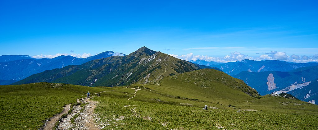
English: Looking south at the Xiangyang Mountain in the middle distance, and Guan Mountain in the far distance. The small mountain in front is Xiangyang North Peak. Xiangyang Mountain is part of the South 2nd segment of the Central Range, with a peak elevation of 3,603 m (11,821 ft) . It is located on the border between Taitung and Kaohsiung.
中文(臺灣):往南望去中間位置是向陽山,在遠方則是關山。前面這座小山是向陽北峰。向陽山是中央山脈南二段的一部分,海拔3,603公尺 (11,821英呎) 。它位於在臺東、高雄的交界。 |
| Date | |
| Source | https://www.flickr.com/photos/junes_hours/20752035124/ |
| Author | Po-Wei CHU |
| Annotations | This image is annotated: View the annotations at Commons |
Licensing edit
| This image was originally posted to Flickr by Po-Wei CHU at https://flickr.com/photos/71487208@N00/20752035124. It was reviewed on 23 June 2016 by FlickreviewR and was confirmed to be licensed under the terms of the cc-by-2.0. |
This file is licensed under the Creative Commons Attribution 2.0 Generic license.
- You are free:
- to share – to copy, distribute and transmit the work
- to remix – to adapt the work
- Under the following conditions:
- attribution – You must give appropriate credit, provide a link to the license, and indicate if changes were made. You may do so in any reasonable manner, but not in any way that suggests the licensor endorses you or your use.
File history
Click on a date/time to view the file as it appeared at that time.
| Date/Time | Thumbnail | Dimensions | User | Comment | |
|---|---|---|---|---|---|
| current | 04:11, 23 June 2016 | 6,000 × 2,449 (9.35 MB) | Liji6085 (talk | contribs) | User created page with UploadWizard |
You cannot overwrite this file.
File usage on Commons
The following page uses this file:
File usage on other wikis
The following other wikis use this file: