File:Y Lon Goed - geograph.org.uk - 230799.jpg
No higher resolution available.
Y_Lon_Goed_-_geograph.org.uk_-_230799.jpg (640 × 480 pixels, file size: 163 KB, MIME type: image/jpeg)
Captions
Captions
Add a one-line explanation of what this file represents
Summary
edit
| Description |
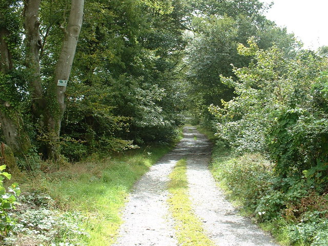
English: Y Lon Goed. "The Tree Road", which stretches 7 or 8 km inland from the coast, reputedly an old quarry supply track. The sign attached to the tree says "Warning: CCTV in Operation", but there is no indication why this area should require such security measures.
Update March 07 [from Alan Fryer]: Y Lôn Goed, more correctly Wood Lane was not a track to any quarry; it was constructed in the early 19th century to link the farms of the Talhenbont estate, and enable the transport of sand and lime from Afonwen beach. The CCTV sign is one of many in the area erected by Gwynedd council to discourage fly-tipping. I am not aware of where, if anywhere, the actual cameras are hidden. |
| Date | |
| Source | From geograph.org.uk |
| Author | David Medcalf |
| Attribution (required by the license) | David Medcalf / Y Lon Goed / |
| Camera location | | View this and other nearby images on: OpenStreetMap |
|---|
_heading:180.00&language=en)
| Object location | | View this and other nearby images on: OpenStreetMap |
|---|
_heading:180.00&language=en)
Licensing
edit

|
This image was taken from the Geograph project collection. See this photograph's page on the Geograph website for the photographer's contact details. The copyright on this image is owned by David Medcalf and is licensed for reuse under the Creative Commons Attribution-ShareAlike 2.0 license.
|
This file is licensed under the Creative Commons Attribution-Share Alike 2.0 Generic license.
Attribution: David Medcalf
- You are free:
- to share – to copy, distribute and transmit the work
- to remix – to adapt the work
- Under the following conditions:
- attribution – You must give appropriate credit, provide a link to the license, and indicate if changes were made. You may do so in any reasonable manner, but not in any way that suggests the licensor endorses you or your use.
- share alike – If you remix, transform, or build upon the material, you must distribute your contributions under the same or compatible license as the original.
- Remove redundant categories and try to put this image in the most specific category/categories
- Remove this template
- The location categories are based on information from this geonames tool and this OpenStreetMap tool combined with a database. You can also have a look at this tool from mysociety.
- The topic category from Geograph was Track (find similar images at Geograph)
File history
Click on a date/time to view the file as it appeared at that time.
| Date/Time | Thumbnail | Dimensions | User | Comment | |
|---|---|---|---|---|---|
| current | 02:49, 1 February 2010 | | 640 × 480 (163 KB) | GeographBot (talk | contribs) | == {{int:filedesc}} == {{Information |description={{en|1=Y Lon Goed. "The Tree Road", which stretches 7 or 8 km inland from the coast, reputedly an old quarry supply track. The sign attached to the tree says "Warning: CCTV in Operation", but there is no i |
You cannot overwrite this file.
File usage on Commons
There are no pages that use this file.