File:Yabuchi Island 20050124-gsi.jpg

Size of this preview: 728 × 600 pixels. Other resolutions: 292 × 240 pixels | 583 × 480 pixels | 933 × 768 pixels | 1,244 × 1,024 pixels | 1,700 × 1,400 pixels.
Original file (1,700 × 1,400 pixels, file size: 401 KB, MIME type: image/jpeg)
Captions
Captions
Add a one-line explanation of what this file represents
Summary
edit| Description |
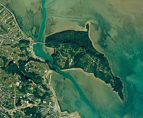
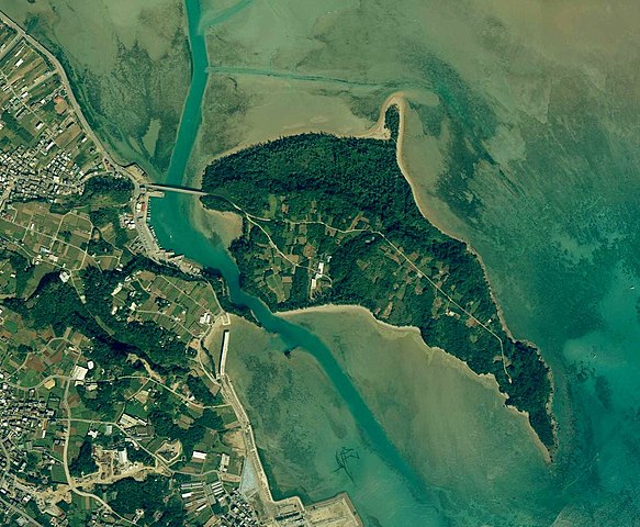
English: Yabuchi Island, Uruma, Okinawa, Japan.
日本語: 藪地島
国土交通省の地図・空中写真閲覧サービスを元に作成。
|
| Date | |
| Source | http://mapps.gsi.go.jp/contentsImageDisplay.do?specificationId=24660 |
| Author |
English: Geospatial Information Authority of Japan
日本語: 国土地理院 |
Licensing
edit
|
The copyright holder of this file, Ministry of Land, Infrastructure, Transport and Tourism, allows anyone to use it for any purpose, provided that the copyright holder is properly attributed. Redistribution, derivative work, commercial use, and all other use is permitted. |
Attribution:
National Land Image Information (Color Aerial Photographs), created by Ministry of Land, Infrastructure, Transport and Tourism, distributed by Geospatial Information Authority of Japan
|

File history
Click on a date/time to view the file as it appeared at that time.
| Date/Time | Thumbnail | Dimensions | User | Comment | |
|---|---|---|---|---|---|
| current | 04:40, 20 June 2018 | | 1,700 × 1,400 (401 KB) | Kugel~commonswiki (talk | contribs) | Color contrast processed |
| 13:25, 20 July 2015 |  | 1,700 × 1,400 (372 KB) | Kugel~commonswiki (talk | contribs) | =={{int:filedesc}}== {{Information |description={{en|1=Yabuchi Island, Uruma, Okinawa, Japan.}} {{ja|1=藪地島 国土交通省の地図・空中写真閲覧サービスを元に作成。 *整理番号 COK20041X *撮影年月日 2005年1月24日 *撮... |
You cannot overwrite this file.
File usage on Commons
The following 2 pages use this file:
File usage on other wikis
The following other wikis use this file:
- Usage on ceb.wikipedia.org
- Usage on de.wikipedia.org
- Usage on ja.wikipedia.org
- Usage on www.wikidata.org
- Usage on zh-min-nan.wikipedia.org
- Usage on zh.wikipedia.org