File:Yamaguchi Cities and Towns.svg

Size of this PNG preview of this SVG file: 602 × 451 pixels. Other resolutions: 320 × 240 pixels | 640 × 479 pixels | 1,024 × 767 pixels | 1,280 × 959 pixels | 2,560 × 1,918 pixels.
Original file (SVG file, nominally 602 × 451 pixels, file size: 28 KB)
Captions
Captions
Add a one-line explanation of what this file represents
Summary
edit
| Description |
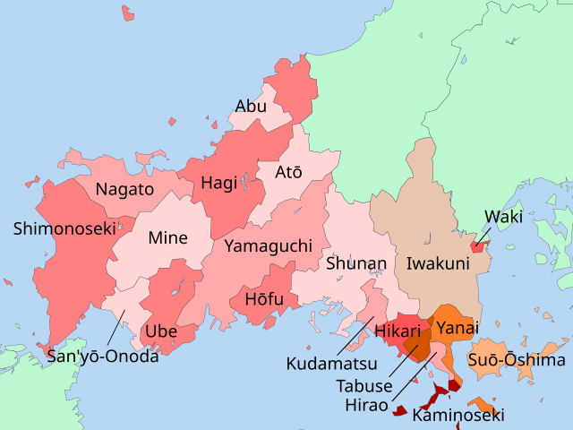
English: A map of towns and cities in Yamaguchi Prefecture, Japan. Places are specified in English. Some towns in the SE part of Yamaguchi are separate islands; color coordination is used to indicate this. |
| Date | |
| Source | File:Map_of_Yamaguchi_Prefecture_Ja-Election_of_2008.svg |
| Author | Toto-tarou, ja:利用者:Lincun |
Licensing
edit
This file is licensed under the Creative Commons Attribution-Share Alike 3.0 Unported license.
- You are free:
- to share – to copy, distribute and transmit the work
- to remix – to adapt the work
- Under the following conditions:
- attribution – You must give appropriate credit, provide a link to the license, and indicate if changes were made. You may do so in any reasonable manner, but not in any way that suggests the licensor endorses you or your use.
- share alike – If you remix, transform, or build upon the material, you must distribute your contributions under the same or compatible license as the original.
File history
Click on a date/time to view the file as it appeared at that time.
| Date/Time | Thumbnail | Dimensions | User | Comment | |
|---|---|---|---|---|---|
| current | 10:45, 18 February 2018 | | 602 × 451 (28 KB) | Douglaspperkins (talk | contribs) | User created page with UploadWizard |
You cannot overwrite this file.
File usage on Commons
There are no pages that use this file.