File:Yellow River Delta Change.gif
Size of this preview: 800 × 534 pixels. Other resolutions: 320 × 214 pixels | 640 × 427 pixels | 1,024 × 684 pixels | 1,280 × 855 pixels | 3,001 × 2,004 pixels.
Original file (3,001 × 2,004 pixels, file size: 7.65 MB, MIME type: image/gif, looped, 2 frames, 4.0 s)
Captions
Captions
Add a one-line explanation of what this file represents
Summary edit
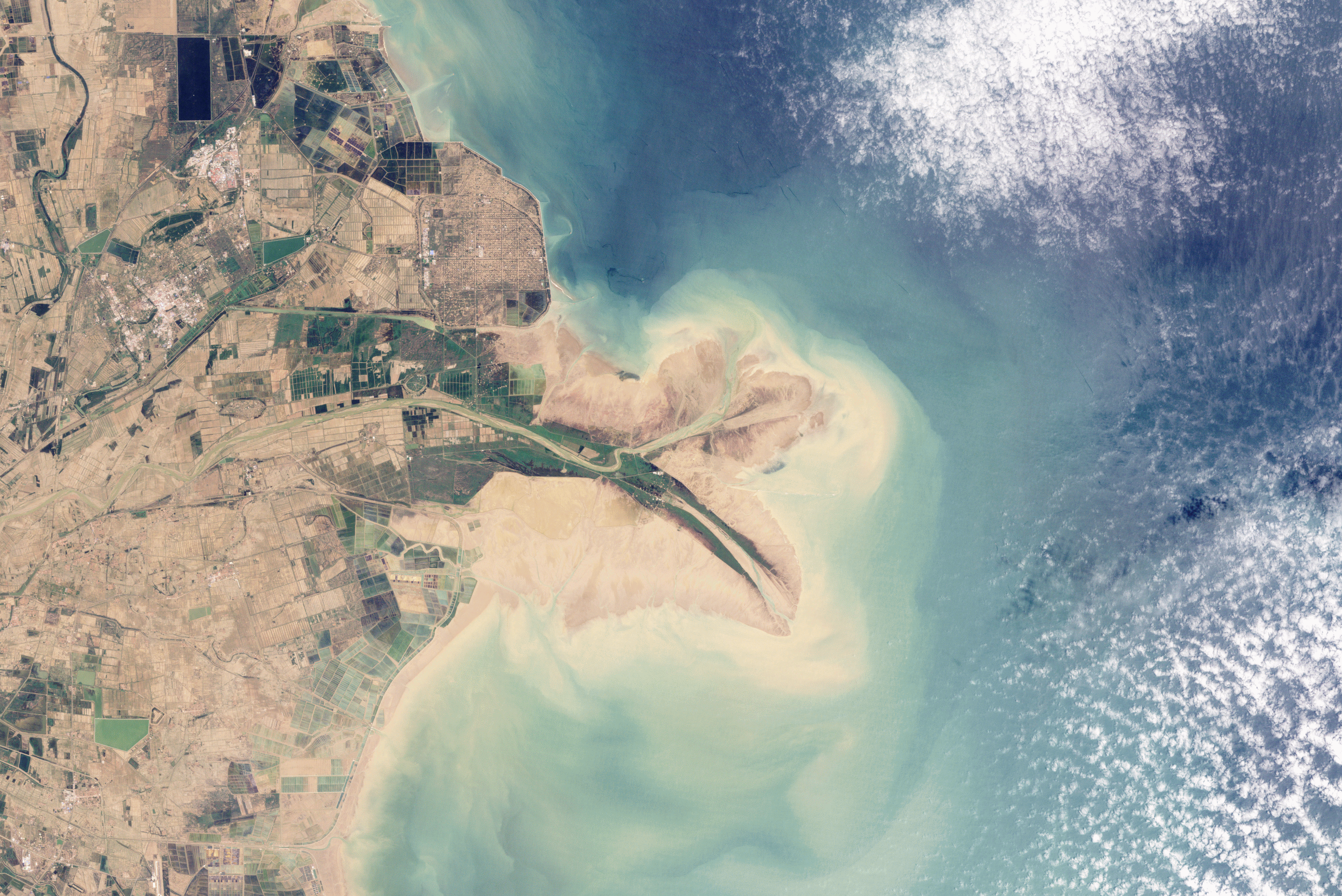
| Description |
English: This pair of natural-colour images shows changes at the Yellow River Delta river mouth over the past two decades. In 1996, Chinese engineers blocked the main channel and forced the river to veer northeast, delivering sediment to a new location. By 2009, a new peninsula had formed, the old one had retreated, and shoreline northwest of the new river mouth had filled in considerably. The filling-in of that section of shoreline may be the outcome that the engineers were anxious to achieve: the land northwest of the newly fortified shoreline is home to an extensive field of oil and gas wells. Their protection is a primary concern. |
| Date | |
| Source | NASA Earth Observatory |
| Author | Robert Simmon |
| Other versions |
|


Instrument: Landsat 5 - TM
Licensing edit
| This file is in the public domain in the United States because it was solely created by NASA. NASA copyright policy states that "NASA material is not protected by copyright unless noted". (See Template:PD-USGov, NASA copyright policy page or JPL Image Use Policy.) | ||
 |
Warnings:
|
| Annotations | This image is annotated: View the annotations at Commons |
File history
Click on a date/time to view the file as it appeared at that time.
| Date/Time | Thumbnail | Dimensions | User | Comment | |
|---|---|---|---|---|---|
| current | 15:24, 28 January 2010 | | 3,001 × 2,004 (7.65 MB) | Originalwana (talk | contribs) | {{Information |Description={{en|1=This pair of natural-colour images shows changes at the Yellow River Delta river mouth over the past two decades.}} |Source=[http://earthobservatory.nasa.gov/IOTD/view.php?id=42439 NASA Earth Observatory] |Author=Robert S |
You cannot overwrite this file.
File usage on Commons
The following 5 pages use this file:
File usage on other wikis
The following other wikis use this file:
- Usage on br.wikipedia.org
- Usage on en.wikipedia.org
- Usage on fr.wikipedia.org
- Usage on la.wikipedia.org
- Usage on ml.wikipedia.org
- Usage on ms.wikipedia.org
- Usage on nn.wikipedia.org